📊 Technical Details
No technical climbing. The trail involves sustained mountain walking at altitude (most stages between 1,500–2,500m) on a mix of well-worn shepherd paths, grassy ridges, and rocky terrain. The ascent of Mount Korab (optional but popular) involves steep loose rock and some minor scrambling but no ropes or technical gear.
Navigation is the primary challenge. The trail is not consistently waymarked and large sections require GPS navigation across pathless terrain. Good physical fitness and previous mountain walking experience are required.
Navigation can be challenging. The trail is inconsistently marked with some sections having clear waymarks while others cross pathless alpine meadows with none. A GPS device loaded with the official trail GPX (available from highscardustrail.com) is essential. Offline maps (Mapy.cz works well) should be downloaded in advance as phone signal is absent across large sections. Local guides of course remove these challenges.
Trail quality is highly variable and run the gammut from Roman-era stone-paved shepherd routes to completely pathless high alpine meadows. Some sections are overgrown. Two sections on the full route require short road transfers where the trail is incomplete. The youth of the trail (established 2017–2020) means infrastructure, waymarking, and accommodation quality vary considerably from stage to stage as development continues.
| T1 | Hiking: clear path, no exposure |
| T2 | Mountain Hiking: some uneven terrain |
| T3 | Difficult Mountain Hiking: exposed sections possible |
| T4 | Alpine Hiking: requires sure-footedness |
| T5 | Difficult Alpine Hiking: climbing experience needed |
| T6 | Very Difficult Alpine Hiking: advanced mountaineering |
| Info | Visit About > rating notes or SAC hiking difficulty ratings |
| A dream | Paved/hardpack (but you might reconsider after a 10-hour day) |
| Too easy | Firm dirt/gravel |
| Mind your step | Loose/uneven |
| A bit of a slog | Ongoing sapping surfaces |
| Make it stop! | A total energy sucker |
📅 Best Season
Best June-September. High passes retain snow until mid-June; some stages are impassable before late June in heavy snow years. July-August is the main season when all accommodation is open and the landscape is at its most vivid. September is excellent with cooler temperatures, fewer insects, and autumn colours beginning on the lower slopes. The trail should not be attempted before late May or after October without winter mountaineering skills. Check current border crossing status with local operators.
💭 Logistics & Budget
Among the most affordable long-distance mountain trails in Europe. Homestay full board (dorm bed, dinner, breakfast, packed lunch) typically costs €15–25pp. In towns like Prizren and Ohrid, comfortable guesthouses are €20–40pp. Guided packages from operators like Zbulo, Shar Outdoors, or Trail Angels run €100–150pp/day fully inclusive. Self-guided hiking with pre-booked accommodation can be done for €30–50pp/day all-in. Albania and Kosovo are two of the cheapest countries in Europe for travel.
No hiking permit required in the usual sense. However, the trail crosses international borders between Kosovo, Albania, and North Macedonia so a valid passport is required at all times (not just an ID card). Border crossing points on the trail are informal mountain crossings. You should check current border status with local operators before departing as regulations can change. Kosovo is not a Schengen member and separate entry/exit rules apply.
Start point: ~1hr by car from Skopje (North Macedonia). Skopje Alexander the Great Airport (SKP) has connections to European cities.
End point: ~40min bus or boat from Ohrid town. Ohrid has a small airport with seasonal European connections.
Tirana (Albania) and Pristina (Kosovo) are also practical entry points for hikers doing the Albanian section only. Local operators provide airport transfers as standard.
Accommodation infrastructure is basic but improving rapidly. The trail is designed around a network of family guesthouses, mountain huts, and shepherd homestays in remote villages — this is the heart of the High Scardus experience. Homestay hospitality (full board typically €15–25pp including dinner, breakfast, and packed lunch) is excellent and likely to include enormous local meals, raki, and a very warm welcome from communities new to international tourism. Some stages end at basic shepherd huts with no electricity or hot water so best to bring a sleeping bag liner. Luggage transfer by vehicle or horse between overnight stops is available through local operators and tour companies. The trail does not lend itself easily to fully independent thru-hiking without local support. A guided or semi-guided arrangement, or at minimum advance booking via local operators, is recommended for the more remote sections.
🎶 Vibe
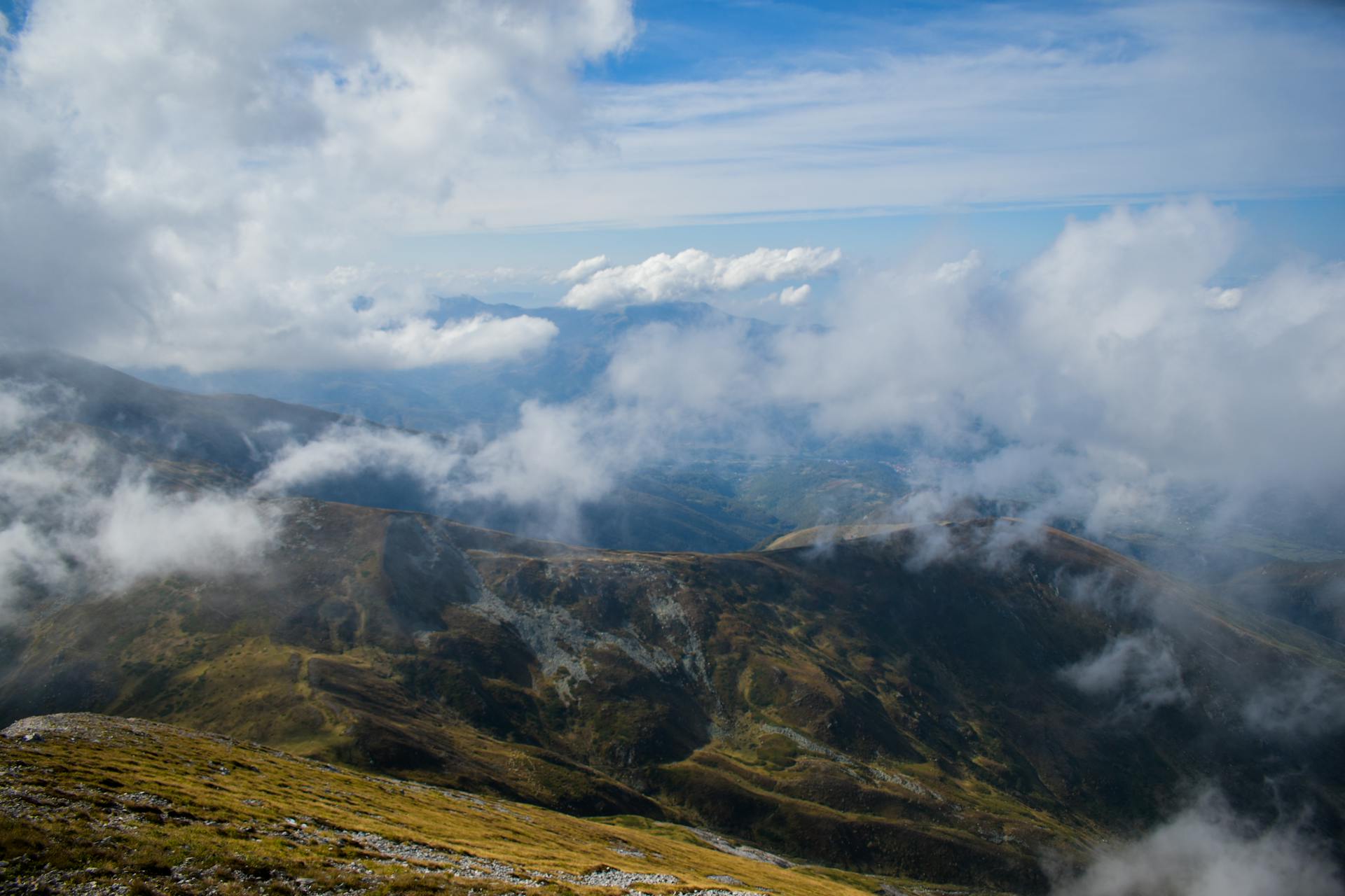
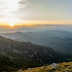
The High Scardus Trail is for those who want the Western Balkans before the world discovers them. The mountains here — the Sharr range, the Korab massif, the Jablanica — are spectacular and completely empty. There are thirty peaks over 2,500m and on many days you will not see another hiker. The communities along the trail are some of the most hospitable on any trail in Europe. Tourism is new enough here that your arrival in a remote village is still a genuine event, and the raki, homemade cheese, and hospitality come from a place of real pride and pleasure rather than commercial habit. The trail passes through three countries with deeply different recent histories. The legacy of the Yugoslav Wars, the Kosovo conflict, and Albania’s long isolation are visible in abandoned structures and changing architecture, but what you encounter most powerfully is resilience, beauty, and extraordinary wildness. The ascent of Mount Korab, highest peak of both Albania and North Macedonia – on a clear day with views into Greece – is among the finest summit experiences in Europe.
🛟 Safety & Inclusion
The primary navigational hazard is getting lost in remote mountain terrain with no phone signal and sparse accommodation. A PLB or satellite communicator is strongly recommended. Afternoon thunderstorms can be violent. The region has bears and wolves — standard precautions apply (no food in tents, make noise on trail). The Kosovo/Albania border crossing sections should be verified as legally open before departure as border status occasionally changes. Kosovo was declared landmine-free in 2001 and there are no current landmine risks on the trail.
📍 Trails in the Same Region
Suggest a correction
Help keep High Scardus Trail accurate. Only the values you change are submitted, and every suggestion is reviewed before going live.