📊 Technical Details
The trail is not waymarked and many sections have no clear path. Confident navigation with map and compass (or GPS) is essential — the Trotternish Ridge in particular requires constant route-finding across trackless terrain. The Bad Step near Camasunary is a short but exposed rock traverse above the sea requiring use of hands; those with a poor head for heights should take the alternative route via Loch na Creitheach. Some sections cross burns that become impassable in spate. Boggy terrain throughout requires careful foot placement. Previous Scottish mountain experience strongly recommended.
No waymarks anywhere on the route and many sections have no clear path, so the ability to navigate with OS maps and/or GPS is essential. The Trotternish Ridge follows an obvious escarpment and is generally straightforward in clear conditions, but mist (very common) requires confident map reading to stay on line and away from cliff edges. Download OS 1:25,000 maps offline before starting. The Cicerone guidebook and Walk Highlands website are the standard references.
Highly variable and often very rough. Tussocky moorland, boggy peat, loose scree, wet rock slabs, and pathless heather are the norm outside of the few maintained paths near tourist attractions. The ridge sections are energy-sapping on the ankles. Dry feet are essentially impossible — expect wet boots within the first hour of most days. Road walking is required on a few sections, notably around Elgol.
| T1 | Hiking: clear path, no exposure |
| T2 | Mountain Hiking: some uneven terrain |
| T3 | Difficult Mountain Hiking: exposed sections possible |
| T4 | Alpine Hiking: requires sure-footedness |
| T5 | Difficult Alpine Hiking: climbing experience needed |
| T6 | Very Difficult Alpine Hiking: advanced mountaineering |
| Info | Visit About > rating notes or SAC hiking difficulty ratings |
| A dream | Paved/hardpack (but you might reconsider after a 10-hour day) |
| Too easy | Firm dirt/gravel |
| Mind your step | Loose/uneven |
| A bit of a slog | Ongoing sapping surfaces |
| Make it stop! | A total energy sucker |
📅 Best Season
Best May–September. May and early June are popular to avoid the infamous Skye midges, which are worst in still, damp conditions from late June through August. July and August are peak season — accommodation must be booked months ahead and wild camping spots near roads can be busy. September offers quieter conditions and beautiful autumn light. Winter hiking is possible for experienced mountaineers but the Trotternish Ridge can be dangerous in snow and ice, and daylight is very short. The trail is technically open year-round.
💭 Logistics & Budget
Budgets in euros at approx 1.15 GBP/EUR. Dirtbag assumes wild camping throughout with food carried from Portree supermarket (Coop). Average assumes a mix of wild camping and B&Bs/bunkhouses in Portree and Sligachan (~£60–90pp). Flashpacker assumes B&Bs every night — Skye accommodation is expensive for rural Scotland. Bothies are free (donations welcome). Portree is the main resupply point; a Coop supermarket has reasonable selection.
No permit required. Wild camping is legal under the Land Reform (Scotland) Act 2003 and the Scottish Outdoor Access Code. Please camp responsibly: use existing fire rings where available or use a stove, leave no trace, and move on after a couple of nights in one spot.
No direct public transport to Rubha Hunish — take the bus from Portree to Duntulm/Flodigarry area (Route 57A, infrequent) then walk ~5km to the tip. Portree is reached by bus from Inverness, Glasgow, or Fort William, or by car over the Skye Bridge from Kyle of Lochalsh (train from Inverness). Broadford has a bus back to Portree and onward connections. No reliable parking at either trailhead for linear walkers — public transport or car shuttle required.
A mix of wild camping (legal and popular under the Scottish Outdoor Access Code) and paid accommodation. There are two bothies on the route: the Lookout Bothy at Rubha Hunish (north end) and Camasunary Bothy (stage 5/6). B&Bs and the Sligachan Hotel are available at key points. Accommodation on Skye books out months in advance in summer and is among the most expensive in rural Scotland — plan well ahead if not wild camping. Portree (midpoint) has the widest selection. There are no albergues or hiker hostels comparable to continental trails; the trail is primarily designed for backpackers camping.
🎶 Vibe
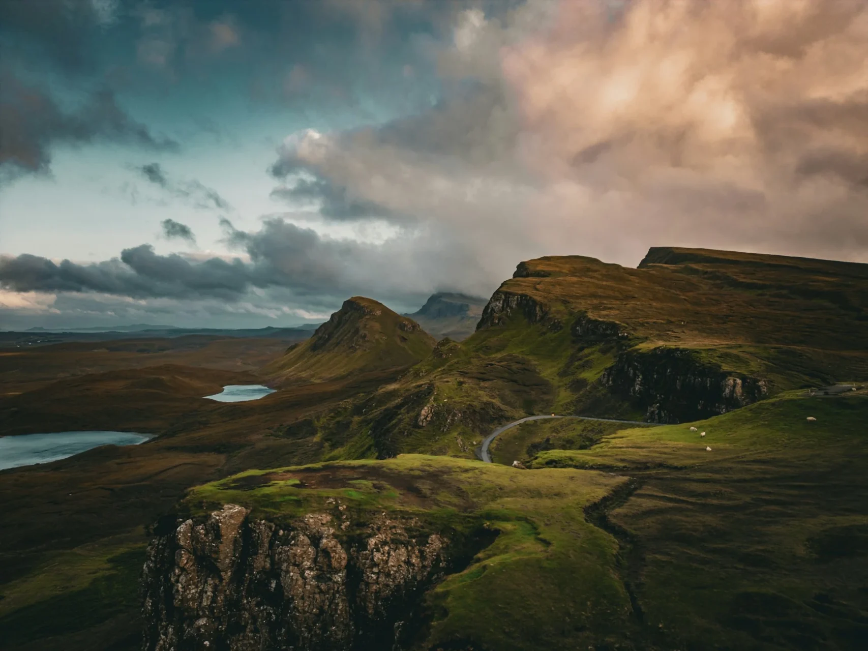
The Skye Trail is the most wild and rewarding multi-day walk in the British Isles. It has everything: the surreal geology of the Trotternish Ridge, the Quiraing’s vertiginous rock pillars, the Old Man of Storr, Glen Sligachan under the shadow of the Black Cuillin, the haunting abandoned village of Boreraig, and the sea-surrounded drama of the Camasunary coast. Skye’s weather is legendary — it rains on the Isle of Skye more than almost anywhere else in Britain, and the mist comes and goes without warning. But this is also part of what makes it so atmospheric. The midges are a genuine torment in summer evenings with no wind. The island has a fierce, proud Gaelic culture and a landscape steeped in clan history and tragedy. There are few places in the UK that leave hikers feeling they have been somewhere truly remote and truly beautiful.
🛟 Safety & Inclusion
The Skye Trail is a serious undertaking. The combination of pathless terrain, frequent mist, rapidly changing weather, and some exposed sections makes it genuinely dangerous for unprepared walkers. Always carry OS 1:25,000 maps and a compass as a backup to GPS. The Bad Step requires a short rock traverse above the sea — assess conditions carefully and take the alternative if in doubt. Burns can rise very quickly in heavy rain and become uncrossable — check weather forecasts and have a contingency plan. Register with Mountain Rescue Scotland (via the Mountain Weather Information Service) before setting out. A PLB or satellite communicator is strongly recommended.
📍 Trails in the Same Region
Suggest a correction
Help keep Skye Trail accurate. Only the values you change are submitted, and every suggestion is reviewed before going live.