📊 Technical Details
Considered the easiest National Trail in England. The central section (Chollerford to Birdoswald) involves repeated short, steep climbs and descents on the Whin Sill crags — this is the only physically demanding section. Both ends are essentially flat. No technical terrain, no scrambling. Well-maintained paths throughout.
National Trail with acorn waymarks throughout. Easy to follow. The urban sections through Newcastle at the start require some attention but are well-signed. The central section is straightforward. Basic guidebook or National Trails app recommended.
Variable underfoot — the urban eastern section involves some pavement and tarmac through Newcastle and suburbs. The central crag section is on grassy paths and rough moorland. The western section along the Solway Firth is flat but can be waterlogged and involves some road walking. Mud is common throughout after rain.
| T1 | Hiking: clear path, no exposure |
| T2 | Mountain Hiking: some uneven terrain |
| T3 | Difficult Mountain Hiking: exposed sections possible |
| T4 | Alpine Hiking: requires sure-footedness |
| T5 | Difficult Alpine Hiking: climbing experience needed |
| T6 | Very Difficult Alpine Hiking: advanced mountaineering |
| Info | Visit About > rating notes or SAC hiking difficulty ratings |
| A dream | Paved/hardpack (but you might reconsider after a 10-hour day) |
| Too easy | Firm dirt/gravel |
| Mind your step | Loose/uneven |
| A bit of a slog | Ongoing sapping surfaces |
| Make it stop! | A total energy sucker |
📅 Best Season
Best May–October. The AD122 bus only runs Good Friday to early October, so spring–autumn is strongly preferred. The central Northumberland section is exposed and can be wet and windy year-round — Northumberland has some of the highest rainfall in England. The Solway Firth section at the end can flood at very high tides (check tide times for sections between Dykesfield and Drumburgh). Winter walking is possible but bleak.
💭 Logistics & Budget
Budgets in euros at approx 1.15 GBP/EUR. Northumberland and Cumbria are notably cheaper than the Cotswolds or southern England. Dirtbag assumes campsites (~£12–16/night) and supermarket food. Average assumes B&Bs (~£50–65pp) with pub dinners. Flashpacker assumes comfortable guesthouses and restaurant meals at the Wall’s heritage hotels. Good value by National Trail standards.
No permit required. National Trail and UNESCO World Heritage Site. A Hadrian’s Wall Path passport (available at the start) can be stamped at forts and museums along the route — a popular memento.
Wallsend: easily reached by Tyne and Wear Metro from Newcastle city centre and Newcastle Airport (Wallsend Metro station). Newcastle has direct rail links from London King’s Cross (~3hrs). Bowness-on-Solway: local bus to Carlisle, then train. Carlisle has direct rail links to London Euston (~3.5hrs) and Glasgow (~1.5hrs). The AD122 bus (named after the year the Wall was built) runs the central section seasonally and is invaluable for section walkers.
Good accommodation coverage throughout, though sparser than southern National Trails. B&Bs, small hotels, and pubs with rooms in most villages along the route. The central section (Once Brewed, Haltwhistle, Gilsland) is well-served for walkers. The AD122 bus service runs the length of the central section from Good Friday to early October, making it easy to reach accommodation slightly off-route. Book ahead in summer. Wild camping is not permitted — the path crosses private land and farmland throughout.
🎶 Vibe
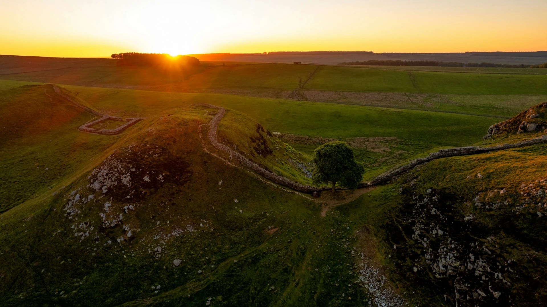
Hadrian’s Wall Path is a history walk as much as a nature walk — the entire route is a UNESCO World Heritage Site and every day brings you past the physical remains of Rome’s northernmost frontier. The central section on the Whin Sill crags is genuinely dramatic, with the Wall running along the edge of a dolerite escarpment with sweeping views north into Northumberland National Park. Housesteads Roman Fort and Vindolanda are world-class archaeological sites worth spending extra time at. The western half is quieter and less dramatic but offers a pleasing transition through Cumbrian farmland to the flat marshes of the Solway. A trail that rewards anyone with even a passing interest in history, and packs more educational punch per kilometre than almost any other walk in Britain.
🛟 Safety & Inclusion
Low-risk trail overall. The central crag section is exposed in bad weather with some modest drops at the cliff edges — normal care applies. The Solway Firth final section can be affected by flooding at very high tides; check tide forecasts before the final day. Note: the famous Sycamore Gap tree was illegally felled in September 2023 — the gap remains but the tree is gone.
📍 Trails in the Same Region


Suggest a correction
Help keep Hadrian’s Wall Path accurate. Only the values you change are submitted, and every suggestion is reviewed before going live.