📊 Technical Details
No technical climbing. The northern section is rolling hills and wadi country on well-trodden paths. The Dana–Petra section involves significant daily ascent and descent with steep scree and rocky terrain, some scrambling over boulders, and wading through Wadi Ghuweir canyon (knee-deep water crossing). The desert section to Wadi Rum and Aqaba is mostly flat open desert on sand and gravel. Heat and water management is the primary challenge, not technical terrain.
The Jordan Trail has almost no waymarks. Hikers must navigate entirely by GPS track (downloadable from jordantrail.org) and topographic maps. Many sections have no discernible path and route-finding across desert terrain, wadi systems, and rocky plateaus requires genuine navigation competence. The Jordan Trail Association strongly recommends hiring a local guide for all but the northernmost section (Umm Qais to Ajloun). Without a guide on the Dana–Petra and desert sections, the risks of getting lost, running out of water, and missing water sources are serious.
Highly variable: the northern section has pleasant compacted earth tracks through farmland; the central section involves rugged, steep wadi terrain with no path; the desert section is open sand and gravel hamada. Some sections involve considerable road walking. The trail is young and in development — quality of marking and maintenance varies enormously by section.
| T1 | Hiking: clear path, no exposure |
| T2 | Mountain Hiking: some uneven terrain |
| T3 | Difficult Mountain Hiking: exposed sections possible |
| T4 | Alpine Hiking: requires sure-footedness |
| T5 | Difficult Alpine Hiking: climbing experience needed |
| T6 | Very Difficult Alpine Hiking: advanced mountaineering |
| Info | Visit About > rating notes or SAC hiking difficulty ratings |
| A dream | Paved/hardpack (but you might reconsider after a 10-hour day) |
| Too easy | Firm dirt/gravel |
| Mind your step | Loose/uneven |
| A bit of a slog | Ongoing sapping surfaces |
| Make it stop! | A total energy sucker |
📅 Best Season
Spring (March–May) and autumn (October–November) are strongly recommended. Spring has the advantage of lush green vegetation in the north and manageable desert temperatures. Autumn is also excellent. Summer (June–September) is extremely dangerous on the desert sections — temperatures exceed 40°C with no shade or water. Winter (December–February) brings cold, rain, and flash flooding risk in wadis; January–February in particular should be avoided. The Dead Sea basin section is hot year-round.
💭 Logistics & Budget
Jordan is mid-range by Middle Eastern standards. Dirtbag assumes wild camping throughout (free), self-catered food from village shops, and minimal paid accommodation. Average assumes a mix of homestays and guesthouses (~15–25 JOD/night with meals) plus tour/guide fees for the desert sections. Flashpacker adds Petra entry, quality Wadi Rum camps, and guide support throughout. Note: the Jordan Pass (~€85) covers the visa fee plus Petra entry and is essential for most international visitors — factor this into the budget. Guides for the Dana–Petra section typically cost 50–80 JOD/day. The trail is not really designed for independent solo hiking without a guide on remote sections.
No overall trail permit. However, entry to the Dana Biosphere Reserve requires a fee paid to the reserve management (contact 0799111434 before entering). Entry to Petra requires a ticket (Jordan Pass covers this and also the visa fee — strongly recommended for international visitors doing the trail). Wadi Rum Protected Area requires an entry fee. The Jordan Pass is the most practical solution for international visitors.
Umm Qais is ~120km north of Amman; accessible by bus or taxi via Irbid. Queen Alia International Airport (Amman) is the main entry point for Jordan. Aqaba at the southern end has its own small international airport (AQJ) with connections to Amman and some European cities. For thru-hikers starting in Umm Qais and finishing in Aqaba, flying into Amman and out of Aqaba is a practical option.
A mix of wild camping, Bedouin homestays, basic guesthouses, and hotels in larger towns. Wild camping is legal throughout Jordan except within the Dana Biosphere Reserve (where designated campsites are required). The trail passes through 52 villages and towns and community-based tourism initiatives provide homestay accommodation in many. In the desert sections (Petra to Wadi Rum and beyond), camping under the stars with Bedouin support is both standard and deeply rewarding. Wadi Rum has a full range of Bedouin camps. The most demanding section logistically is the stretch from Petra to Aqaba through the Wadi Rum desert, where resupply points are sparse and a support arrangement (guide, camel/vehicle for water and food) is essential for independent hikers.
🎶 Vibe
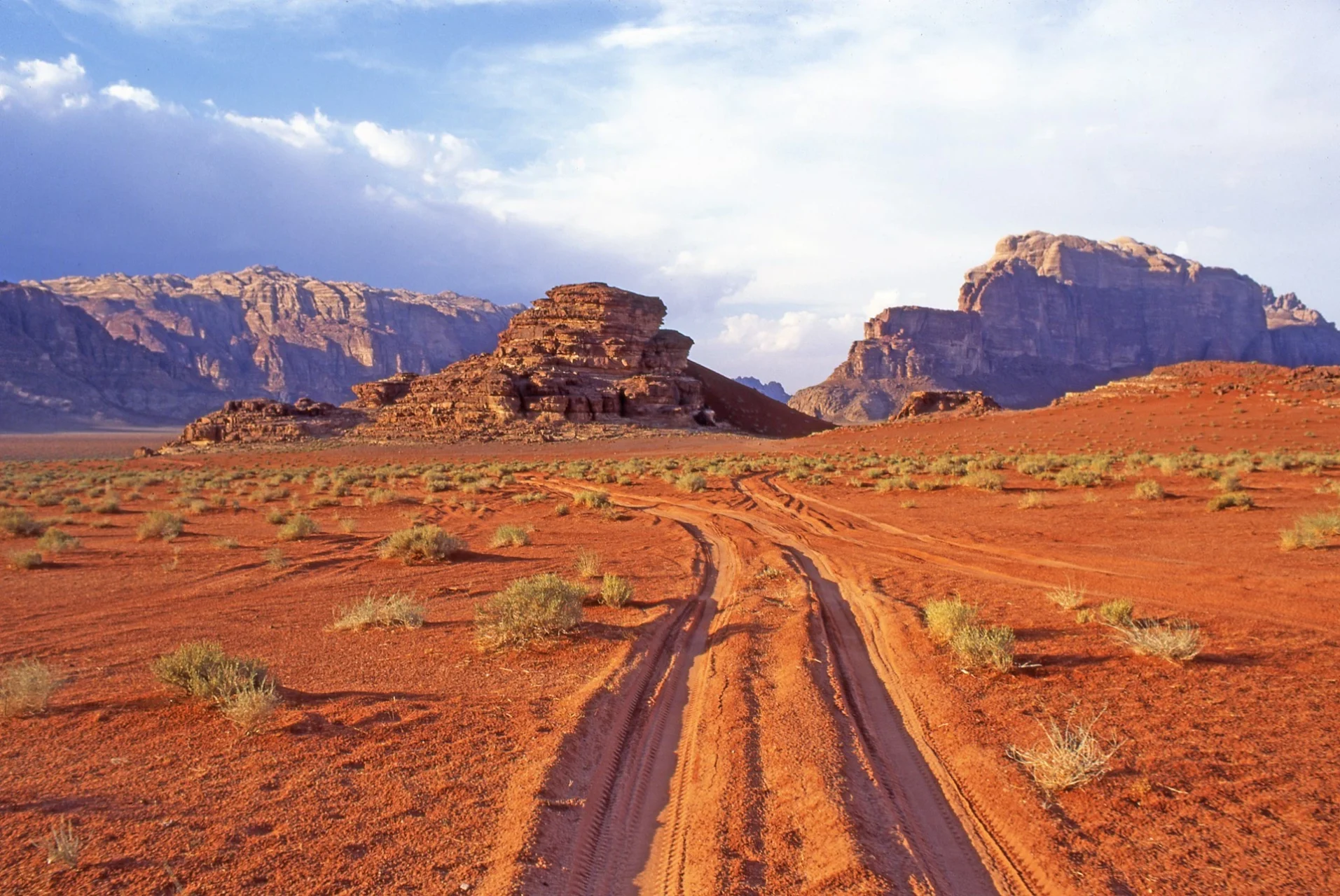
The Jordan Trail is one of the most culturally immersive long-distance hikes in the world. Jordanian hospitality — chai appearing from nowhere in village cafes, Bedouin families insisting you eat with them, farmers leaving their work to point you in the right direction — is not a tourism construct but an ancient cultural imperative. The landscapes shift dramatically: oak forests and Roman ruins in the green north, the extraordinary canyon wilderness of Dana and Wadi Ghuweir, the rose-red sandstone of Petra approached from its secret Bedouin back entrance, and then the vast godlike silence of Wadi Rum. The trail passes through the King’s Highway, one of the world’s oldest trading routes — Moses, Jesus, and the Nabataean merchants all walked versions of this landscape. The Dana to Petra section alone is among the finest multi-day hikes in the world. More people should be doing this trail.
🛟 Safety & Inclusion
The trail itself is safe from a security standpoint — Jordan is one of the most stable countries in the Middle East and tourists are not targets. The main hazards are heat and dehydration in desert sections (life-threatening in summer), flash flooding in wadis after rain (can happen very suddenly — never camp in a wadi), and getting lost on unmarked sections without water. Water sources are the critical logistical challenge: carry more than you think you need, know your next reliable source, and arrange water support for the desert sections. Emergency services are limited in remote areas — a satellite communicator is strongly recommended.
🔗 Similar Trails
📍 Trails in the Same Region


Suggest a correction
Help keep Jordan Trail accurate. Only the values you change are submitted, and every suggestion is reviewed before going live.