📊 Technical Details
No technical terrain on the main trail. The Negev desert sections involve steep canyon walls, scree, and some scrambling but nothing requiring ropes or technical equipment. The northern Galilee section is rolling hills on good paths. The main challenges are endurance, heat management, and water logistics — not technical difficulty. The first section from Eilat (if hiking SOBO) is often cited as the toughest technically, with steep ascents on loose rock.
One of the best-marked trails in the world — orange-blue-white stripe markers appear every few metres on rocks, trees, and posts throughout the entire route. Getting seriously lost is very difficult. The Red Book guidebook (available in English and Hebrew) provides detailed daily descriptions. GPS apps (Israel Hiking Map app, freely available) are a useful backup. The only navigation challenge is the Negev where markers can be hard to spot on desert rock.
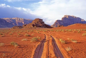
Highly varied — the northern sections are on well-maintained paths through forest and agricultural land; the central sections include some unavoidable road walking through suburban areas; the Negev is loose desert sand, gravel hamada, and rocky canyon terrain. The urban sections through Tel Aviv suburbs are dull but brief. The Negev is physically demanding: loose surfaces, significant daily elevation, and extreme heat require a different mental approach to the rest of the trail.
| T1 | Hiking: clear path, no exposure |
| T2 | Mountain Hiking: some uneven terrain |
| T3 | Difficult Mountain Hiking: exposed sections possible |
| T4 | Alpine Hiking: requires sure-footedness |
| T5 | Difficult Alpine Hiking: climbing experience needed |
| T6 | Very Difficult Alpine Hiking: advanced mountaineering |
| Info | Visit About > rating notes or SAC hiking difficulty ratings |
| A dream | Paved/hardpack (but you might reconsider after a 10-hour day) |
| Too easy | Firm dirt/gravel |
| Mind your step | Loose/uneven |
| A bit of a slog | Ongoing sapping surfaces |
| Make it stop! | A total energy sucker |
📅 Best Season
Two windows: mid-February to mid-May (SOBO, south to north — start in Eilat before the desert gets too hot) or September to December (NOBO, north to south). Spring hiking from the south is the most popular approach among Israeli thru-hikers. Autumn is the most reliable weather window for international hikers starting in the north. Summer is extremely dangerous on the Negev section (temperatures over 45°C). Winter brings cold, rain and even snow in the Galilee mountains, and flash flood risk in desert wadis. The Shabbat (Friday sundown to Saturday night) should be factored into planning — shops close and some sections through religious communities are best avoided.
💭 Logistics & Budget
Israel is expensive for the Middle East but the Trail Angel system and free designated campsites make it surprisingly affordable for thru-hikers. Dirtbag assumes free camping and trail angels throughout, supermarket food (~€7/day), and minimal paid accommodation. Average adds occasional hostel nights (Tel Aviv, Jerusalem, Eilat), restaurant meals in cities, and water caching costs for the Negev (~€80–120 total). Flashpacker adds hotel nights and restaurant dining in urban sections. Note: water caching for the Negev desert section is a mandatory additional cost (approx. €50–100 depending on method — contact local service providers at least 2 weeks before reaching the desert). Israel’s tap water is safe to drink throughout.
No hiking permit required. The trail is free and open year-round. Some nature reserve sections have signposted entrance areas but no fees for walkers on the trail. A separate ticket is required to visit Masada (not on the original route but on a popular variant). The trail carries a unique striped marker (orange-blue-white) that appears every few metres.
Kibbutz Dan: accessible by bus from Kiryat Shmona; train or bus from Tel Aviv to Kiryat Shmona (~3hrs). Ben Gurion Airport (Tel Aviv) is the main international gateway. Eilat: accessible by bus from Tel Aviv (~5hrs) or a short flight (Eilat Airport/Ramon Airport). The trail passes through Tel Aviv and within reach of Jerusalem — easy to start or end the urban sections from major transport hubs.
The northern and central sections are served by the famous ‘Trail Angel’ (Mal’ache Shvil) network — approximately 150 private individuals who offer hikers free (or near-free) accommodation, showers, meals, and a place to pitch a tent in their garden. This is perhaps the most remarkable hospitaliy system on any long-distance trail in the world and is a defining feature of the experience. Free designated campsites exist throughout nature reserves. Hotels, kibbutz guesthouses, and hostels are available in cities (Tel Aviv and Jerusalem are trail highlights worth spending extra days in). The southern Negev section (approximately 400km) passes through very sparsely populated desert where wild camping in designated reserve sites is standard and there is no other option. Abraham Hostels in both Jerusalem and Tel Aviv are the gold standard for hikers passing through.
🎶 Vibe
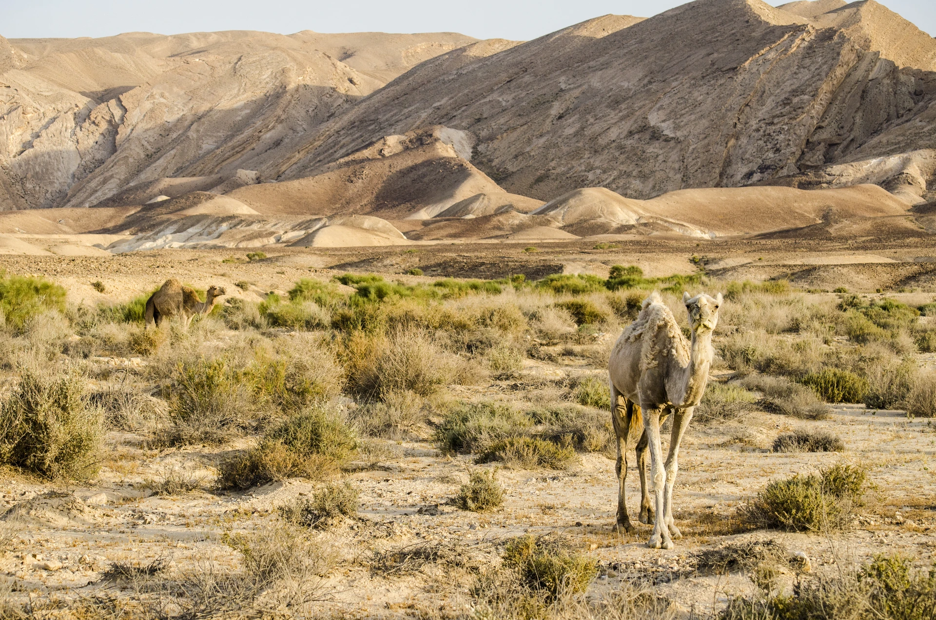
The Israel National Trail is one of the most extraordinary long-distance walks in the world — a continuous thread from the green, spring-fed forests of the Galilee through Mediterranean coastline, Judean desert, the edges of Jerusalem, and into the vast, ancient wilderness of the Negev. The Trail Angel network is unlike anything else in hiking: strangers invite you into their homes, feed you, do your laundry, and send you off in the morning with a packed lunch. The trail passes biblical landscapes and modern kibbutzim in the same afternoon. It is almost entirely walked by Israeli hikers — meeting locals who have an intense personal relationship with this land, often recently out of military service, is an experience that no guided tour can replicate. The Negev section is humbling in its scale and silence: craters (makhteshim) the size of cities, Nabataean ruins a thousand years old, ibex on canyon rims at sunrise. Completing the Israel National Trail gives you a more honest and nuanced understanding of this complicated, beautiful country than anything else you could do.
🛟 Safety & Inclusion
The trail is exceptionally safe by global standards — violent crime against hikers is essentially unknown. The route is carefully planned to avoid the West Bank and disputed territories. Heat and dehydration in the Negev is the main life-threatening hazard; carry 6–10 litres of water on desert sections and never rely on a single water source. Flash flooding in desert wadis can be sudden and deadly — never camp in a wadi and always check weather forecasts. Water caching for the Negev is a critical logistics requirement, not optional. Emergency number 100 (police) will coordinate rescue.
🔗 Similar Trails
📍 Trails in the Same Region


Suggest a correction
Help keep Israel National Trail accurate. Only the values you change are submitted, and every suggestion is reviewed before going live.