📊 Technical Details
No technical climbing, but the Pennine Way is the toughest of the National Trails and should not be underestimated. The bog navigation on Kinder Scout, Bleaklow, and Black Hill is genuinely disorienting in poor visibility. Cross Fell to Garrigill is the hardest day — 33km with 1,000m of ascent over England’s highest ground outside the Lake District. The Cheviot final stage is long, remote, and exposed. Flagstone paths have improved conditions on the worst bogs but wet weather makes everything harder.
National Trail with acorn waymarks, but marking is considerably less dense than southern trails and much of the route crosses featureless bog and moorland where markers are widely spaced. Mist on Kinder Scout, Bleaklow, or the Cheviots with poor visibility requires confident compass/map work. OS 1:25,000 maps are essential, not optional. The Cheviots final stage in particular demands careful navigation.
The bogs are legendary and real. The Peak District and South Pennines sections involve miles of knee-deep peat hags and cotton grass. Flagstone paving has helped the worst sections but cannot tame everything. After rain, sections of the route are genuinely impassable for extended periods. Kinder Scout and Bleaklow in bad visibility are serious navigation challenges. Bring waterproof gaiters and accept that your boots will be wet most of the time.
| T1 | Hiking: clear path, no exposure |
| T2 | Mountain Hiking: some uneven terrain |
| T3 | Difficult Mountain Hiking: exposed sections possible |
| T4 | Alpine Hiking: requires sure-footedness |
| T5 | Difficult Alpine Hiking: climbing experience needed |
| T6 | Very Difficult Alpine Hiking: advanced mountaineering |
| Info | Visit About > rating notes or SAC hiking difficulty ratings |
| A dream | Paved/hardpack (but you might reconsider after a 10-hour day) |
| Too easy | Firm dirt/gravel |
| Mind your step | Loose/uneven |
| A bit of a slog | Ongoing sapping surfaces |
| Make it stop! | A total energy sucker |
📅 Best Season
Best May–September. Summer gives the longest days for the extended Cheviot stage and best chance of dry conditions. August brings purple heather on the moors — magnificent. Spring can be excellent but snow remains on Cross Fell into May. Autumn gives beautiful light but shortening days and increasing bog. Winter attempts are rare and require full mountain equipment — Cross Fell is notorious for England’s strongest winds and worst weather. The Tan Hill Inn (England’s highest pub, on the route) provides essential mid-route morale.
💭 Logistics & Budget
Dirtbag assumes YHA hostels and campsites where available (~£20–30/night) and supermarket food. Average assumes B&Bs (~£55–75pp) and pub meals. Flashpacker assumes comfortable guesthouses and restaurant dinners. The North Pennines section is notably cheaper than the Peak District and Yorkshire Dales. The remote Northumberland section has fewer options at all price points — book well ahead.
No permit required. National Trail.
Edale: direct train from Manchester Piccadilly and Sheffield (~45min). Excellent rail access — the preferred approach. Kirk Yetholm: bus to Kelso, then connections to Edinburgh or Berwick-upon-Tweed for rail. Berwick-upon-Tweed (~25 miles east) has direct trains to London, Edinburgh, and Newcastle. Not ideal but manageable.
Britain’s oldest National Trail has accommodation ranging from YHA hostels (important: some have closed in recent years — check current status before relying on them) to B&Bs, pubs with rooms, and campsites. The infrastructure is thinner than on southern trails — some stages have limited options and a few sections require careful advance booking, especially the remote northern stretches through Northumberland. Wild camping is not permitted in England. The final Cheviot stage (Byrness to Kirk Yetholm, 43km) has no accommodation en route — two emergency refuge bothies exist but are basic; most walkers either do it in one very long day or split it via Mountain Refuge Hut.
🎶 Vibe
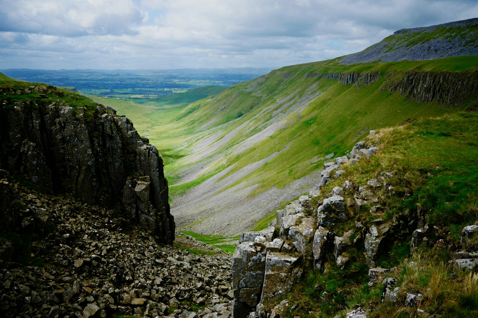
The Pennine Way is Britain’s original long-distance trail and it carries that weight proudly. This is not a comfortable walk — it will test you on the first day and not relent. The famous bogs of Bleaklow and Kinder Scout, the desolate beauty of Teesdale, the drama of High Cup Nick (a sudden clifftop revelation that genuinely stops you in your tracks), the emotional resonance of Hadrian’s Wall at sunset, and the brutal, exhilarating final slog through the Cheviots to Kirk Yetholm — each of these is a distinct experience. Completing it earns you real respect in British hiking circles. The tradition of drinking a Wainwright-sponsored pint at the Border Hotel in Kirk Yetholm on finishing (free for completers — an offer made by Alfred Wainwright that cost him £15,000 before his death) remains intact. A trail that has broken many people and defined many more.
🛟 Safety & Inclusion
The Pennine Way passes through genuinely remote upland terrain. Cross Fell–Garrigill and the Cheviot stage are serious undertakings in bad weather — carry full waterproofs, map, compass, and emergency shelter. The bogs on Kinder Scout can disorient even experienced walkers in mist. Mobile signal is unreliable throughout the North Pennines and Cheviots. Tell someone your itinerary before the final Cheviot stage.
📍 Trails in the Same Region


Suggest a correction
Help keep Pennine Way accurate. Only the values you change are submitted, and every suggestion is reviewed before going live.