📊 Technical Details
The Lake District section involves serious fell walking with significant ascent and descent, exposed ridges (optional Striding Edge/Helvellyn variant requires scrambling confidence), and challenging navigation in mist. Kidsty Pike is a steep rough descent on loose rock. The Yorkshire Dales and North York Moors sections are more straightforward. Overall more demanding than most National Trails but less severe than the Pennine Way.
Now a National Trail with improved waymarking since 2026. Previously one of the least-signed popular walks in England — the upgrade has addressed much of this. OS 1:25,000 maps are still recommended, particularly for the Lake District fells where mist can descend rapidly. The Vale of York section is flat and straightforward. Harvey Maps produces a dedicated 1:40,000 strip map widely used by C2C walkers.
Very variable — the Lake District stages are on rocky fell paths and can be rough and boggy; the Yorkshire Dales are on good tracks and paths through farmland; the Vale of York section involves some unavoidable road walking; the North York Moors are heather moor paths. The overall quality is better than the Pennine Way but the Lake District days demand respect.
| T1 | Hiking: clear path, no exposure |
| T2 | Mountain Hiking: some uneven terrain |
| T3 | Difficult Mountain Hiking: exposed sections possible |
| T4 | Alpine Hiking: requires sure-footedness |
| T5 | Difficult Alpine Hiking: climbing experience needed |
| T6 | Very Difficult Alpine Hiking: advanced mountaineering |
| Info | Visit About > rating notes or SAC hiking difficulty ratings |
| A dream | Paved/hardpack (but you might reconsider after a 10-hour day) |
| Too easy | Firm dirt/gravel |
| Mind your step | Loose/uneven |
| A bit of a slog | Ongoing sapping surfaces |
| Make it stop! | A total energy sucker |
📅 Best Season
Best May–September. Walking west to east puts the prevailing wind at your back and the sun on your face for most of the day — the traditional and recommended direction. The Lake District section is best in clear weather to enjoy the ridge walks; bad visibility on Kidsty Pike is the most common cause of difficulties. Autumn is beautiful in the North York Moors when the heather turns. Winter is possible but the Lake District section requires full mountain gear.
💭 Logistics & Budget
Budgets in euros at approx 1.15 GBP/EUR. The Lake District section is expensive — busy tourist infrastructure with higher B&B prices. The Yorkshire Dales section is mid-range. The North York Moors is the most affordable. Dirtbag assumes campsites and cooking own food. Average assumes B&Bs (~£55–80pp) and pub meals. Baggage transfer (if used) adds approximately £15–20/day per bag.
No permit required. Designated National Trail from 2026.
St Bees: train from Carlisle (45min) or Barrow-in-Furness. Carlisle has direct trains from London Euston (~3hrs) and Glasgow. Robin Hood’s Bay: bus to Whitby (~20min) or Scarborough, then train. Scarborough to Manchester ~3hrs. The traditional end-to-end approach means leaving a car at one end or using a shuttle service — several operators offer car transfers between the two ends.
Good accommodation throughout, with B&Bs, pubs, and campsites in most overnight stops. The Lake District section is the busiest and most popular — book well ahead in summer. The Vale of York section has the sparsest accommodation. Wild camping is not permitted in England but is available in the Lake District on open access land above the fell wall. Baggage transfer services are widely available and very popular on this route. Now a National Trail (from 2026) with improved signage and infrastructure.
🎶 Vibe
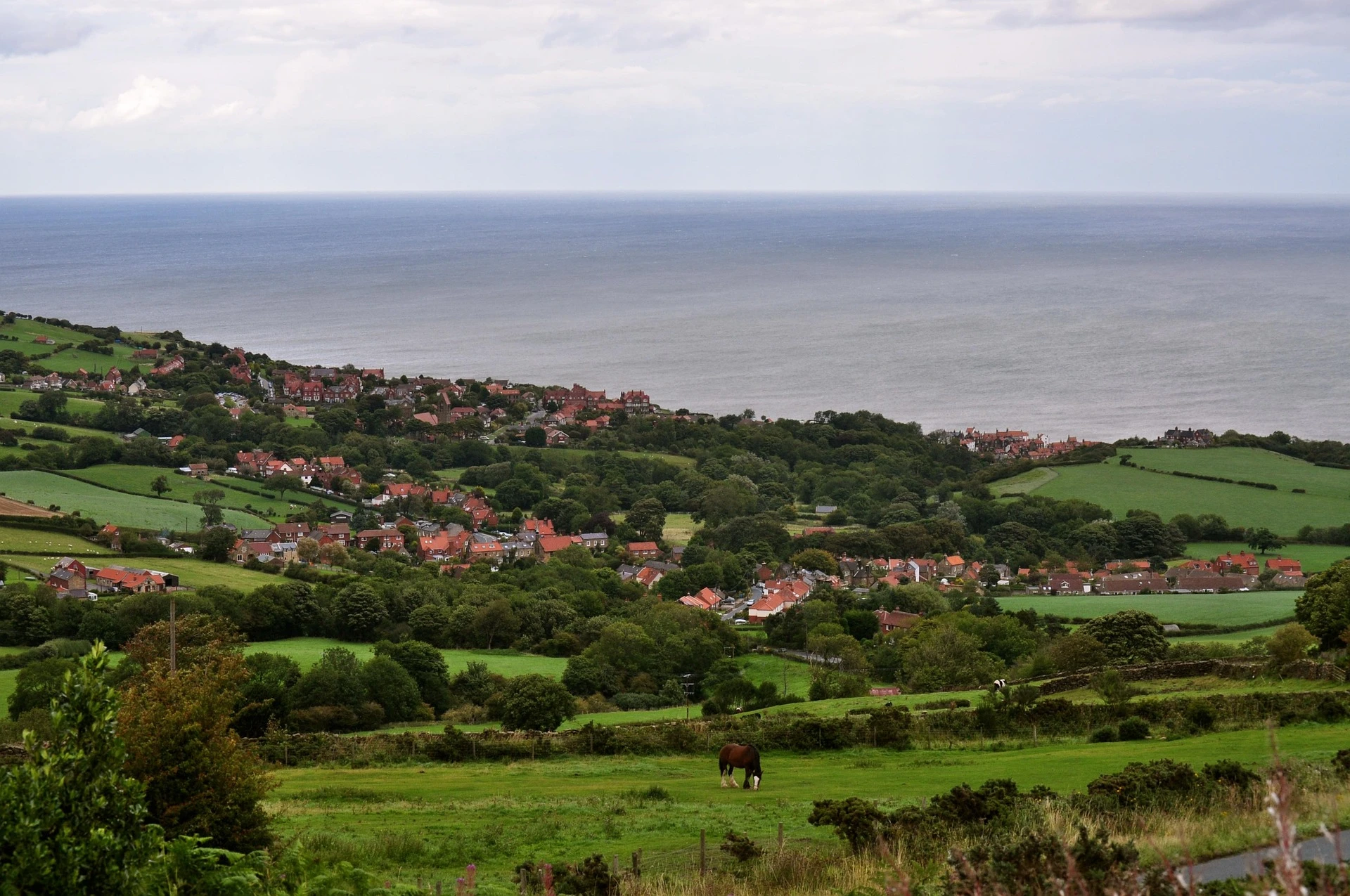
Devised by Alfred Wainwright in 1973 and now officially a National Trail, the Coast to Coast is one of England’s great walks — and for many, the finest. Its genius is variety: in two weeks you move through three utterly distinct national parks and three distinct kinds of English landscape. The Lake District days are among the best mountain walking in England — the crossing of the Helvellyn massif, the long descent to Kidsty Pike above Haweswater, the moment you step off the fells into the Eden Valley. The Yorkshire Dales bring stone barns and sweeping green dales. The North York Moors offer open heather and then, suddenly, the sea. The tradition of dipping boots in the Irish Sea at the start and the North Sea at the end — carrying a pebble from St Bees to deposit in Robin Hood’s Bay — gives the walk a pleasing ritual structure. The Border Hotel in Kirk Yetholm has a C2C logbook; Robin Hood’s Bay has the Bay Hotel at the water’s edge for the finishing pint.
🛟 Safety & Inclusion
The Lake District section involves high, exposed fells with serious consequences if navigation fails in mist. Striding Edge on Helvellyn (an optional variant) is a genuine ridge scramble — do not attempt in strong wind or icy conditions. Always carry OS maps and compass in addition to phone GPS. The rest of the route is straightforward in good weather.
📍 Trails in the Same Region


Suggest a correction
Help keep Coast to Coast Walk accurate. Only the values you change are submitted, and every suggestion is reviewed before going live.