📊 Technical Details
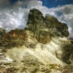
The Adlerweg ranges considerably in difficulty — 1 easy stage, 20 moderate, and 12 challenging. The most difficult stages (particularly through the central Karwendel and the Lechtaler Alps, stages 19–24) include via ferrata cable sections, exposed ridges, seasonal snowfields, and loose scree. The Lechtaler stages are the most technically demanding and include some secured rock passages. Less fit hikers can use official lower-level variants on the hardest stages. Overall more demanding than most Central European long-distance trails but below alpine technical routes.
Well-signed throughout with the distinctive eagle symbol and red-white-red Austrian waymarks. Junction signposts with estimated times are frequent. A guidebook (Cicerone publishes the English-language standard) and 1:50,000 maps are recommended for the Karwendel and Lechtal sections where high routes cross featureless terrain in mist.
Varied — the valley sections use forest tracks and roads; the mountain stages are on good Alpine paths but include significant scree, loose rock, and some via ferrata cables. Afternoon thunderstorms are the primary daily nuisance in July–August and can turn exposed sections dangerous. The stage 13 interruption at Innsbruck (requiring an 8km city walk or bus to reconnect the route) is a minor structural annoyance.
| T1 | Hiking: clear path, no exposure |
| T2 | Mountain Hiking: some uneven terrain |
| T3 | Difficult Mountain Hiking: exposed sections possible |
| T4 | Alpine Hiking: requires sure-footedness |
| T5 | Difficult Alpine Hiking: climbing experience needed |
| T6 | Very Difficult Alpine Hiking: advanced mountaineering |
| Info | Visit About > rating notes or SAC hiking difficulty ratings |
| A dream | Paved/hardpack (but you might reconsider after a 10-hour day) |
| Too easy | Firm dirt/gravel |
| Mind your step | Loose/uneven |
| A bit of a slog | Ongoing sapping surfaces |
| Make it stop! | A total energy sucker |
📅 Best Season
Mid-June to mid-September. High passes retain snow until late June; the highest stages require crampons before mid-June. July–August is peak season — huts busy, thunderstorms daily, but maximum daylight. Late June and September are the preferred windows for experienced hikers: fewer crowds, stable weather, autumn colour in September. Some huts close after mid-September. The East Tyrol extension through the Hohe Tauern is higher and snowier than the main route — start no earlier than early July.
💭 Logistics & Budget
Budgets in euros. Dirtbag assumes dorm beds in huts without demi-pension and self-catered food. Average assumes hut demi-pension (dorm bed, dinner, breakfast, ~€50–65pp) most nights. Flashpacker adds valley hotel nights in towns like Innsbruck and private rooms. ÖAV membership (€65/year) pays for itself within a few hut nights. Austria is not cheap — hut demi-pension is genuinely good value for the quality offered but budget hikers should bring a sleeping bag liner and consider half-board carefully.
No permit required. The Adlerweg is a waymarked public trail. ÖAV (Austrian Alpine Club) membership provides a significant discount (typically 50%) on hut accommodation fees and is worth obtaining for a multi-week traverse.
St. Johann in Tirol: direct train connections from Salzburg (~1hr) and Innsbruck (~45min). Innsbruck Airport has flights to major European cities. St. Christoph am Arlberg: train to St. Anton am Arlberg (direct connections to Innsbruck and Zurich). Innsbruck at the midpoint of the main route is the largest city and best transport hub — flights, trains, and buses to all Austrian and European destinations.
The Adlerweg has one of the finest hut-to-hut accommodation networks in the Alps. Every stage ends at a staffed Austrian Alpine Club (ÖAV) mountain hut, inn, or hotel — carrying a tent is entirely optional. Austrian huts are deservedly famous: warm, welcoming, substantial dinners (demi-pension typically €45–65pp), and a genuine Tyrolean atmosphere. Advance booking is essential from late June to late August — popular central Karwendel huts book out weeks ahead. Wild camping is not permitted in Tyrol. Note: the North Tyrol main route (stages 1–24) and the East Tyrol extension (stages O1–O9) are geographically separated; a road transfer of ~3 hours is required between the two. Most hikers do one section or the other rather than the complete combined route.
🎶 Vibe
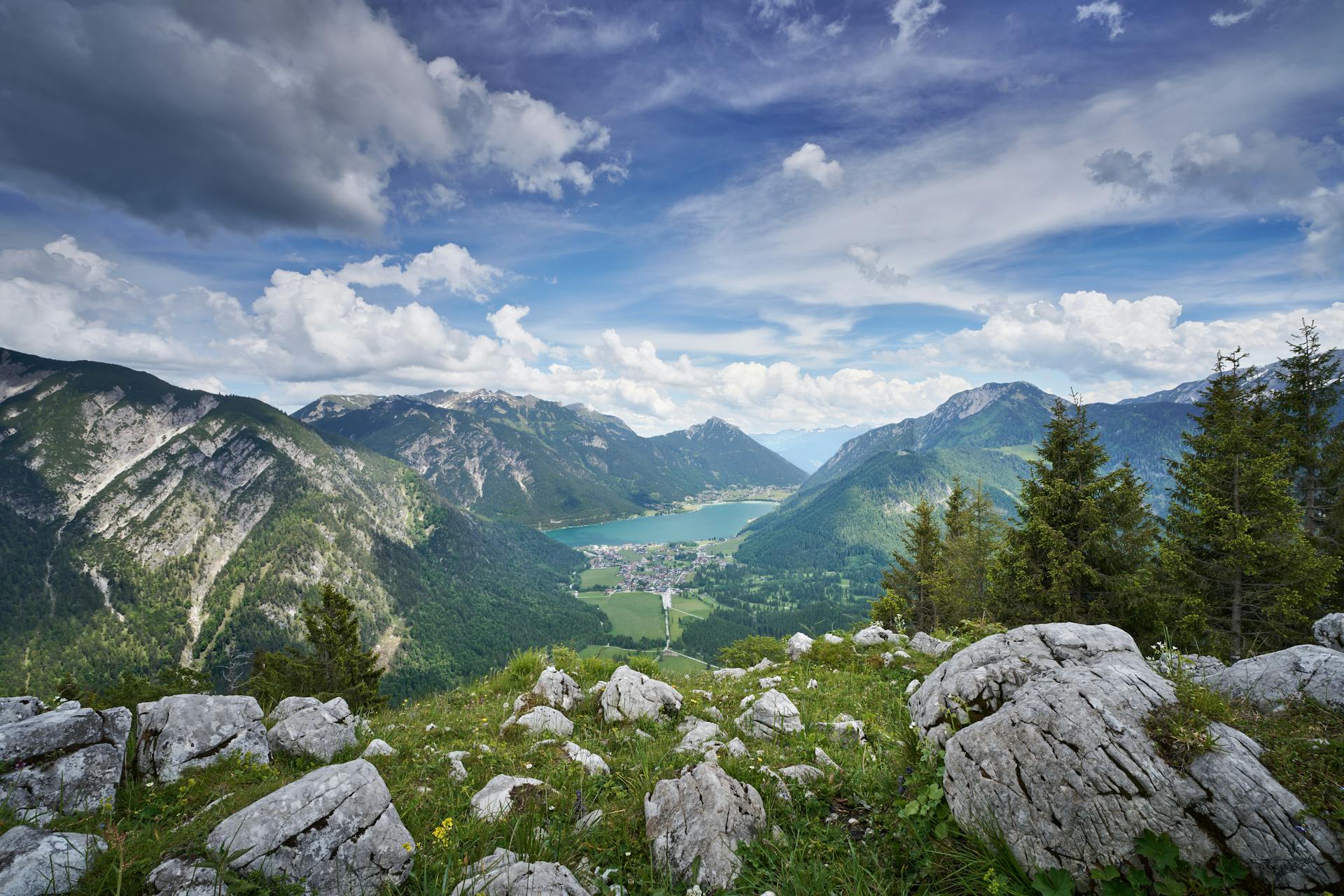
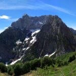
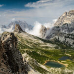
The Adlerweg is the premier showcase of Austrian Alpine culture and scenery. The hut system is exceptional — proper kitchens, convivial dining rooms, enormous portions of Tyrolean food, and a genuine warmth that distinguishes Austrian huts from their Swiss or French equivalents. The Karwendel section, passing through the largest protected Alpine area in Austria, offers days of wilderness walking with the dramatic backdrop of 1,000m limestone walls. Innsbruck at the midpoint is a gift — a proper city with world-class restaurants, museums, and the Nordkette cable car rising from the city centre into the mountains above. The Lechtal Alps finale (stages 19–24) is the most demanding and most spectacular section: remote, serrated limestone ridges with very few other walkers. The eagle silhouette visible on a map is not just a marketing conceit — it captures something real about the route’s sweep across the full breadth of the Tyrol.
🛟 Safety & Inclusion
Afternoon thunderstorms on exposed ridges are the primary hazard — build quickly in the Austrian Alps in summer. The Lechtaler stages have exposed sections where a slip has serious consequences. Seasonal snow on the Gradötzscharte and Karwendel passes may require crampons in June. Follow hut warden advice on weather windows. Mountain rescue (Bergrettung) in Austria is excellent but expensive without travel insurance.
📍 Trails in the Same Region

Suggest a correction
Help keep Eagle Walk (Adlerweg) accurate. Only the values you change are submitted, and every suggestion is reviewed before going live.