📊 Technical Details
The GR10 is a serious mountain trail requiring good fitness and basic mountain experience — more demanding than the average long-distance walk but less technical than the HRP. The central section crosses passes up to 2,734m with steep, rocky terrain. Early-season crossings (June) require crampons on some passes. A small number of stages include exposed sections and boulder scrambling. The western and eastern sections are lower and more forgiving. The route is waymarked throughout, removing the main navigation challenge of the HRP.
Waymarked throughout with standard red-and-white GR blazes, one of the better-maintained long-distance trail networks in France. Navigation is generally straightforward, though markers can be widely spaced on high passes in poor visibility. The four FFRP topo-guides or Cicerone guidebook are standard references. IGN 1:25,000 maps and an offline mapping app (IGN Géoportail) are recommended for the central section.
The GR10 descends into every major valley — by design, to access accommodation and resupply — which means the climbing is relentless and much of the elevation gain is ‘wasted’ compared to the HRP’s ridge-following approach. The Ariège section (central-eastern) involves particularly deep valley crossings with corresponding massive ascents. Trail surfaces range from excellent mountain paths to loose scree and occasional boulder fields. Some sections use tarmac roads through village approaches.
| T1 | Hiking: clear path, no exposure |
| T2 | Mountain Hiking: some uneven terrain |
| T3 | Difficult Mountain Hiking: exposed sections possible |
| T4 | Alpine Hiking: requires sure-footedness |
| T5 | Difficult Alpine Hiking: climbing experience needed |
| T6 | Very Difficult Alpine Hiking: advanced mountaineering |
| Info | Visit About > rating notes or SAC hiking difficulty ratings |
| A dream | Paved/hardpack (but you might reconsider after a 10-hour day) |
| Too easy | Firm dirt/gravel |
| Mind your step | Loose/uneven |
| A bit of a slog | Ongoing sapping surfaces |
| Make it stop! | A total energy sucker |
📅 Best Season
Mid-June to late September. The western (Basque) section can be walked from May. The central high section requires crampons on some passes until early July. July–August is peak season: refuges and gîtes book out weeks in advance and the path is busy on popular sections around Gavarnie and Cauterets. September is excellent: quieter, stable weather, vivid autumn light on the Basque and Mediterranean sections. The route should not be attempted in the central section in winter without full alpine equipment.
💭 Logistics & Budget
Dirtbag assumes gîte demi-pension on cheaper stages and wild camping or refuge camping on others (~€15–25/night) with self-catered food where possible. Average assumes gîte demi-pension most nights (~€40–50 all-in). Flashpacker adds occasional hotel stays in larger towns (Luchon, Ax-les-Thermes). Cash is essential — many refuges and gîtes are cash-only, especially in the central sections. Budget an extra €200–300 for contingency cash to carry in the mountains.
No permit required. National park camping regulations apply within the Parc National des Pyrénées. Four official FFRP topo-guides cover the complete route (Pyrénées Occidentales, Centrales, Ariégeoises, Orientales) and are recommended alongside digital maps.
Hendaye: TGV from Paris Montparnasse ~5hrs via Bayonne; local train from San Sebastián. Banyuls-sur-Mer: TGV to Perpignan (~5hrs from Paris Gare de Lyon) then regional train south. Several intermediate towns on the GR10 (Pau, Lourdes/Tarbes, Luchon, Ax-les-Thermes, Perpignan) have good rail connections for section hikers.
The GR10 has the best accommodation network of the three trans-Pyrenean routes. Staffed gîtes d’étape (walker hostels with meals) are available on or near most stages; staffed refuges (CAF) cover the high mountain sections; and valley towns and villages provide hotels and chambres d’hôte. Gîte demi-pension (dorm bed, dinner, breakfast) costs approximately €35–55. CAF refuges in the high mountains cost approximately €18–25 for a dorm bed; meals extra. Wild camping is permitted within the Parc National des Pyrénées only within 1 hour of a refuge or lake, between 7pm and 9am. Outside the national park, wild camping is technically restricted but widely tolerated with discretion. Booking ahead is essential for high-season (July–August) on the central stages — Gavarnie, Cauterets, and Luz-Saint-Sauveur fill quickly. Carry cash; many remote gîtes and refuges are card-free.
🎶 Vibe
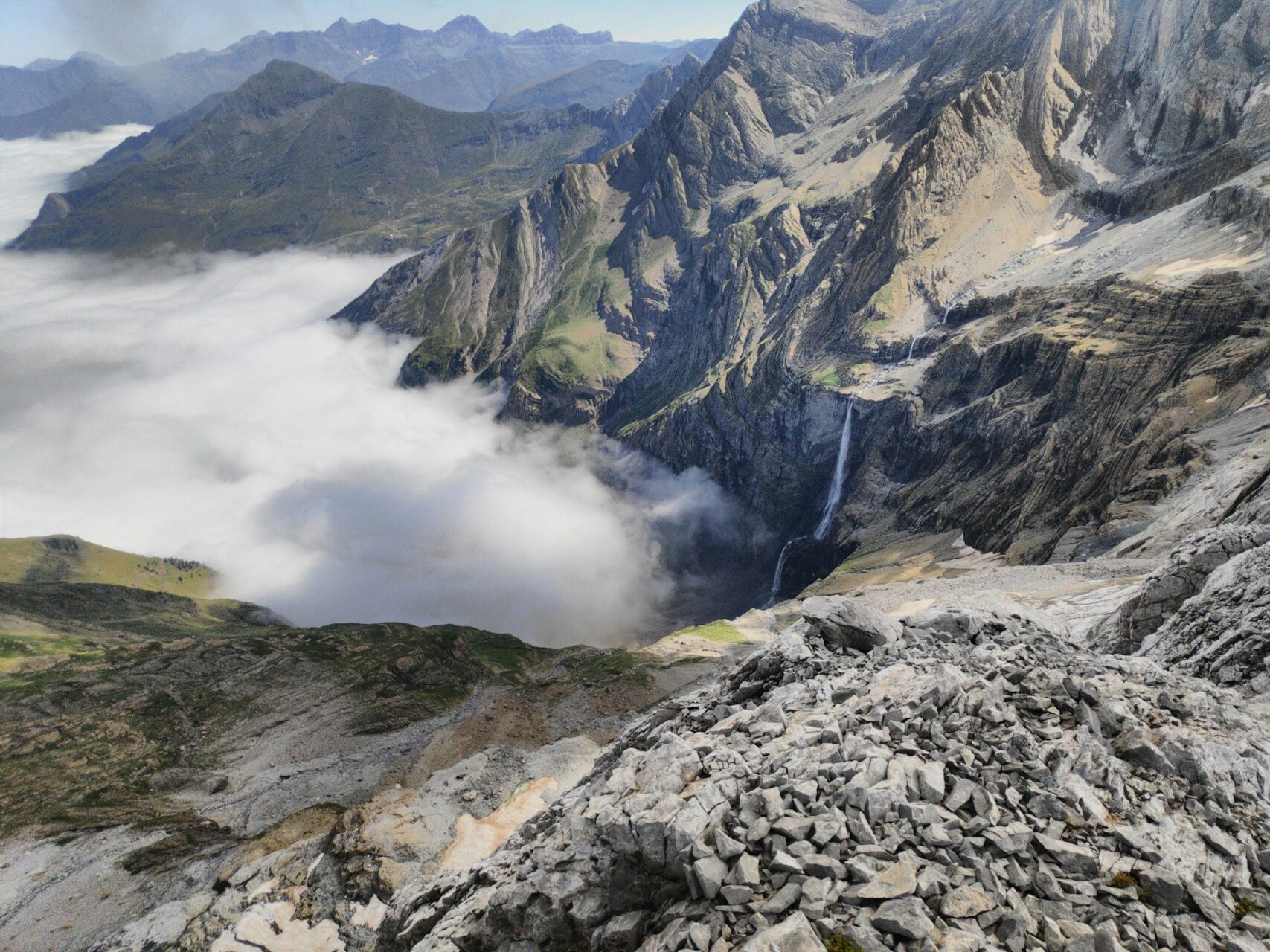
The GR10 is the French Pyrenees in its entirety — from the soft Atlantic green of the Basque Country, where the mountains are gentle and the villages are white-walled with red shutters, through the dramatic granite cirques of the Hautes-Pyrénées with their thundering waterfalls and glacier-polished rock, through the deep forested valleys of the Ariège, and finally into the sun-bleached scrubland of Roussillon where the Mediterranean shimmers on the horizon. The gîte culture is one of the great pleasures of the GR10: arriving at a small family-run hostel after 8 hours on the mountain to a three-course dinner and a table of strangers who will become friends by the second bottle of wine. The Cirque de Gavarnie — visible from the trail in the central section — is one of the great natural theatres of Europe. The GR10 is longer and lower than the HRP, but in many ways more human: it passes through French mountain culture rather than above it.
🛟 Safety & Inclusion
The primary hazard is afternoon thunderstorms on high passes — build quickly and are violent. Always plan to be off high ground by early afternoon. Snow and ice on early-season passes require crampons and ice axe competence. The trail descends into every valley, which means fatigue from constant up-and-down can lead to accidents on steep descents. A PLB or satellite communicator is strongly recommended for the central high section. Carry the FFRP topo-guide emergency contact numbers.
📍 Trails in the Same Region


Suggest a correction
Help keep GR10 accurate. Only the values you change are submitted, and every suggestion is reviewed before going live.