📊 Technical Details
The most demanding of the three trans-Pyrenean routes. While the standard HRP avoids true technical climbing, it crosses 23 passes above 2,500m and includes several exceptional-grade stages with steep and exposed terrain requiring great care. Crampons and ice axe are required for early-season crossings (June–early July) on several stages. Some variants involve straightforward glacier travel. Route-finding on unmarked terrain in mist is a genuine navigational challenge. Not suitable for inexperienced mountain walkers — prior alpine experience is strongly recommended.
Almost entirely unmarked — occasional cairns and faded red-and-white marks are the only indicators. A GPS device loaded with the HRP track (available from the Cicerone guidebook or hrpguide.org) is essential, not optional. IGN 1:25,000 maps for the French side and Editorial Alpina maps for the Spanish side should be carried. Navigation in mist on high, featureless terrain is the primary challenge. The Cicerone guide by Ton Joosten is the standard reference; more recent GPS tracks from doingmiles.com or Walking with Wired are widely used supplements.
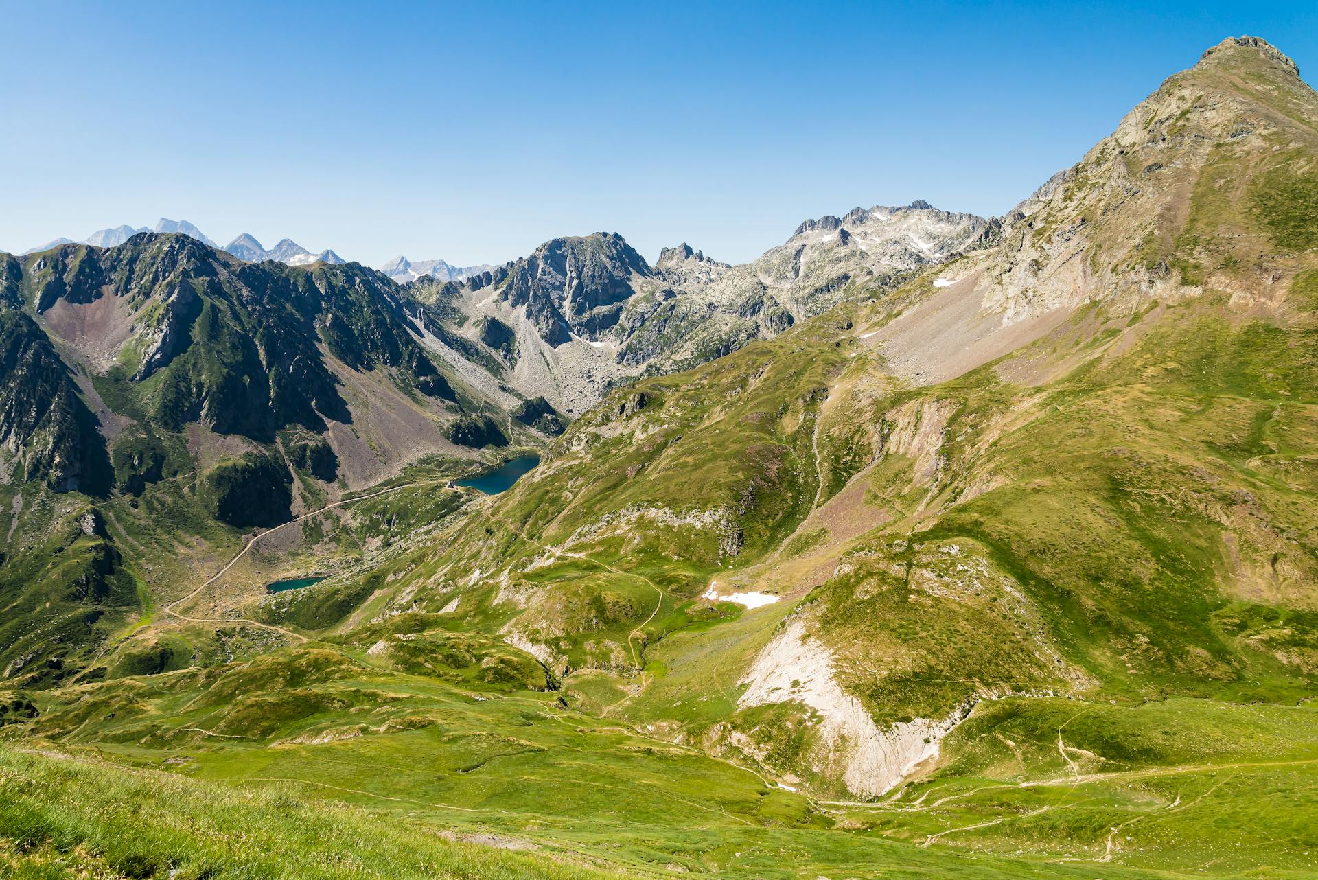
Consistently rough mountain terrain — boulder fields, scree, steep grass, loose rock, and glacier remnants. The HRP was designed to stay as high as possible, which means it rarely follows the easy path. Some days involve genuine off-trail navigation across trackless terrain. The constant up-and-down rhythm (an estimated 1,200m of ascent per day on average) accumulates fatigue relentlessly. Afternoon thunderstorms are a serious hazard in July and August on exposed ridges.
| T1 | Hiking: clear path, no exposure |
| T2 | Mountain Hiking: some uneven terrain |
| T3 | Difficult Mountain Hiking: exposed sections possible |
| T4 | Alpine Hiking: requires sure-footedness |
| T5 | Difficult Alpine Hiking: climbing experience needed |
| T6 | Very Difficult Alpine Hiking: advanced mountaineering |
| Info | Visit About > rating notes or SAC hiking difficulty ratings |
| A dream | Paved/hardpack (but you might reconsider after a 10-hour day) |
| Too easy | Firm dirt/gravel |
| Mind your step | Loose/uneven |
| A bit of a slog | Ongoing sapping surfaces |
| Make it stop! | A total energy sucker |
📅 Best Season
Late June to mid-September. The central Pyrenees retain significant snow until early July — crampons and ice axe are mandatory before mid-July on many stages. Late June/early July is spectacular but requires full winter kit. July and August offer the most reliable weather but afternoon thunderstorms are frequent and violent — always be off high ridges by early afternoon. September is increasingly popular: less crowded, stable weather, but some refuges begin to close from mid-September. The route should not be attempted outside this window without full alpine expedition experience.
💭 Logistics & Budget
Dirtbag assumes tent camping and self-carried food (resupply every 3 days in valley towns). Average assumes a mix of camping and refuge stays with half-board (~€55 French side, €35–40 Spanish side). Flashpacker assumes refuge every night. French refuges are significantly more expensive than Spanish refugios. Cash is essential — many refuges do not take cards, and ATMs are sparse in the high mountains. Carry enough cash for 4–5 days between towns.
No hiking permit required. National park camping regulations apply within the Parc National des Pyrénées (France) and Ordesa y Monte Perdido (Spain). Andorra requires no visa for EU citizens; non-EU hikers should check requirements — it is a separate country with its own border controls.
Hendaye: TGV from Paris Montparnasse ~5hrs; also reachable from San Sebastián by local train. Banyuls-sur-Mer: TGV to Perpignan (~5hrs from Paris Gare de Lyon) then regional train south; also reachable from Barcelona. Both ends well-served by public transport. A car is impractical given the linear route.
Unlike the GR10 and GR11, the HRP has no dedicated accommodation network — it was designed primarily as a high-level route for self-sufficient mountaineers carrying tents. Wild camping is the default and is widely practised, though rules vary: in France’s Parc National des Pyrénées camping is permitted only within 1 hour of a refuge or lake, between 7pm and 9am; in Spain camping is officially prohibited but widely tolerated if practiced discreetly (arrive late, leave early, avoid refuges and national park boundaries). Most stages end near a staffed refuge on the GR10 or GR11, or in a valley village — the Cicerone guidebook maps these options. French refuges cost approximately €55/night for half-board; Spanish refugios are typically 30% cheaper. A tent is strongly recommended as a backup even for hut-to-hut hikers; several stages are too long or the terrain too difficult to guarantee reaching accommodation on schedule.
🎶 Vibe
The HRP is for those for whom the GR10 and GR11 are not enough. It exists to stay high — resolutely, stubbornly, joyfully high — crossing the watershed between France and Spain at every opportunity and descending to the valleys only when the terrain absolutely demands it. The result is one of Europe’s great wilderness experiences: days spent at 2,000–2,500m with no path, no signs, and occasionally no other hikers visible in any direction. The Cirque de Gavarnie from above. The Vignemale glacier. The crossing into Andorra. The Mediterranean vineyards of the final stages after six weeks above the treeline. The HRP attracts a self-selecting community of serious mountain walkers who know what they’re doing and chose this route over the easier alternatives precisely because it is harder. Meeting another HRP hiker at a remote refuge is a genuine moment of kinship.
🛟 Safety & Inclusion
The HRP is a serious mountain route. Afternoon thunderstorms on exposed ridges are the primary acute hazard — they can build in under an hour and are violent; lightning on high cols has killed hikers. Always have an exit plan from high ground before 2pm. Snow and ice on early-season crossings require ice axe and crampons competence. Route-finding errors in mist at high altitude can lead to dangerous terrain. Carry a PLB or satellite communicator. Register planned routes with Météo-France and SafeTravel Spain.
📍 Trails in the Same Region


Suggest a correction
Help keep Haute Route Pyrénéenne (HRP) accurate. Only the values you change are submitted, and every suggestion is reviewed before going live.