📊 Technical Details
The GR11 is consistently demanding throughout its central section, with 10 passes above 2,500m compared to just one on the GR10. Daily elevation gains of 800–1,500m are standard. The terrain is rockier and more exposed than the GR10 in the central section; some stages require basic scrambling. Crampons are required on several passes until early July. The western (Basque/Navarre) and eastern (Catalonia) sections are significantly gentler. No technical climbing required on the standard route.
Red-and-white GR waymarks throughout, but marking quality is inconsistent — some sections are well-signed while others have faded or missing markers, especially in the central Aragonese section. Navigation skills and a GPS track are strongly recommended. The Cicerone guidebook by Brian Johnson is the standard English-language reference. Editorial Alpina maps (1:40,000) are the best paper mapping for the route. Download offline maps before each section as phone signal is absent across large areas.
Rocky, rough mountain terrain throughout the central section. The GR11 holds higher ground than the GR10 and crosses fewer roads, but the price is consistently demanding underfoot conditions — loose scree, steep grass, rocky paths, and occasional boulder fields. The constant valley-to-ridge-to-valley rhythm is physically relentless. The eastern Catalan section is noticeably easier. Summer heat in the lower-elevation eastern sections can be significant.
| T1 | Hiking: clear path, no exposure |
| T2 | Mountain Hiking: some uneven terrain |
| T3 | Difficult Mountain Hiking: exposed sections possible |
| T4 | Alpine Hiking: requires sure-footedness |
| T5 | Difficult Alpine Hiking: climbing experience needed |
| T6 | Very Difficult Alpine Hiking: advanced mountaineering |
| Info | Visit About > rating notes or SAC hiking difficulty ratings |
| A dream | Paved/hardpack (but you might reconsider after a 10-hour day) |
| Too easy | Firm dirt/gravel |
| Mind your step | Loose/uneven |
| A bit of a slog | Ongoing sapping surfaces |
| Make it stop! | A total energy sucker |
📅 Best Season
Best July–September. High central passes are snow-covered until early July — crampons required before mid-July on several stages. July–August is peak season with the best weather but afternoon thunderstorms are frequent and can be severe on exposed ridges. September is excellent: quieter, cooler, and reliable weather. The western (Basque) section can be walked from May. The eastern (Catalan) section is accessible almost year-round. The route is genuinely dangerous in the central section before late June without winter mountaineering equipment.
💭 Logistics & Budget
Notably cheaper than the GR10. Dirtbag assumes camping and self-catered food supplemented by refugio meals on staged stops. Average assumes refugio demi-pension most nights (~€30–40 all-in). Spanish refugios are significantly cheaper than French equivalents. Benasque is the main mid-route town for proper resupply and rest. Cash essential throughout. Overall very good value for the quality of mountain experience.
No permit required. National park regulations apply within Ordesa y Monte Perdido and Aigüestortes i Estany de Sant Maurici. Andorra is an independent country with its own border — no visa required for EU citizens or most passport holders for short visits.
Cabo de Higuer/Hondarribia: easily reached from Irun station (local ferry from Hondarribia to Fuenterrabía); Irun has direct trains from Madrid (~5hrs), Bilbao, and San Sebastián. Cap de Creus: accessible by taxi/bus from Cadaqués or Figueres; Figueres has AVE connections to Barcelona and Madrid. Several intermediate towns (Pamplona, Jaca, Benasque, Vielha, La Seu d’Urgell) have bus connections for section hikers.
Less well-served than the GR10 but adequate for most stages. Staffed refugios (mountain huts) cover the high sections; village hostels and rural guesthouses (casas rurales) appear in valley towns. Some stages in the central section end at unstaffed shelters (cabanas) with no facilities — carrying a tent provides essential flexibility. Refugio demi-pension costs approximately €30–40 all-in (cheaper than French equivalents). Wild camping is officially prohibited in Spain but widely tolerated along the GR11 if practiced discreetly: arrive late, leave early, do not light fires, and avoid camping near staffed refugios or within national park boundaries. In Ordesa y Monte Perdido national park, camping is permitted only above 2,000m between sunset and sunrise. Carry cash — many refugios do not take cards.
🎶 Vibe
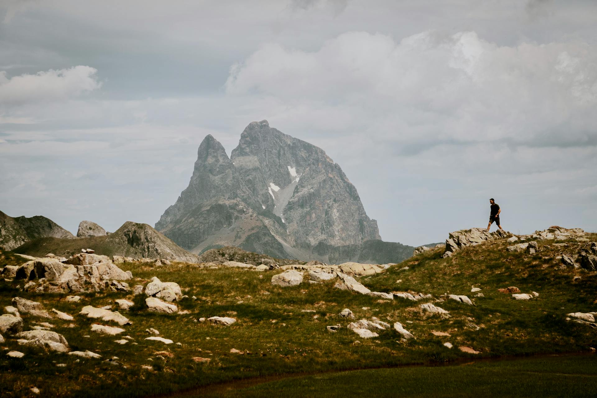
The GR11 is the Spanish side of the coin: drier, hotter, rawer, and less infrastructurally polished than the GR10, but with a different and compelling character. The Aragonese Pyrenees — Ordesa, the Posets-Maladeta massif, the Benasque valley in the shadow of Pico de Aneto — are among the most spectacular mountains in Europe and the GR11 passes through all of them. The refugio culture has a wonderful directness to it: enormous meals, rough wine, and a dorm full of Spanish mountaineers who want to talk about the route. The trail crosses Andorra — tiny, duty-free, and slightly surreal — and finishes at Cap de Creus, the easternmost point of Spain, where the Pyrenees meet the Mediterranean. Less well-known internationally than the GR10 but highly regarded by serious Pyrenean hikers; the central section from Isaba to Benasque is considered by many to be the finest mountain walking in the Pyrenees.
🛟 Safety & Inclusion
Afternoon thunderstorms on high ridges and passes are the primary hazard — violent, fast-developing, and frequent in July–August. Always plan to be off high ground by early afternoon and have shelter options identified. Snow on early-season passes requires ice axe and crampon competence; several hikers have been killed on icy slopes in June. The route is more remote than the GR10 — some sections have no habitation for 2–3 days. Carry a PLB or satellite communicator. Flash flooding in gorges is possible after heavy rain — check weather before entering canyon sections.
📍 Trails in the Same Region


Suggest a correction
Help keep GR11 (Senda Pirenaica) accurate. Only the values you change are submitted, and every suggestion is reviewed before going live.