📊 Technical Details
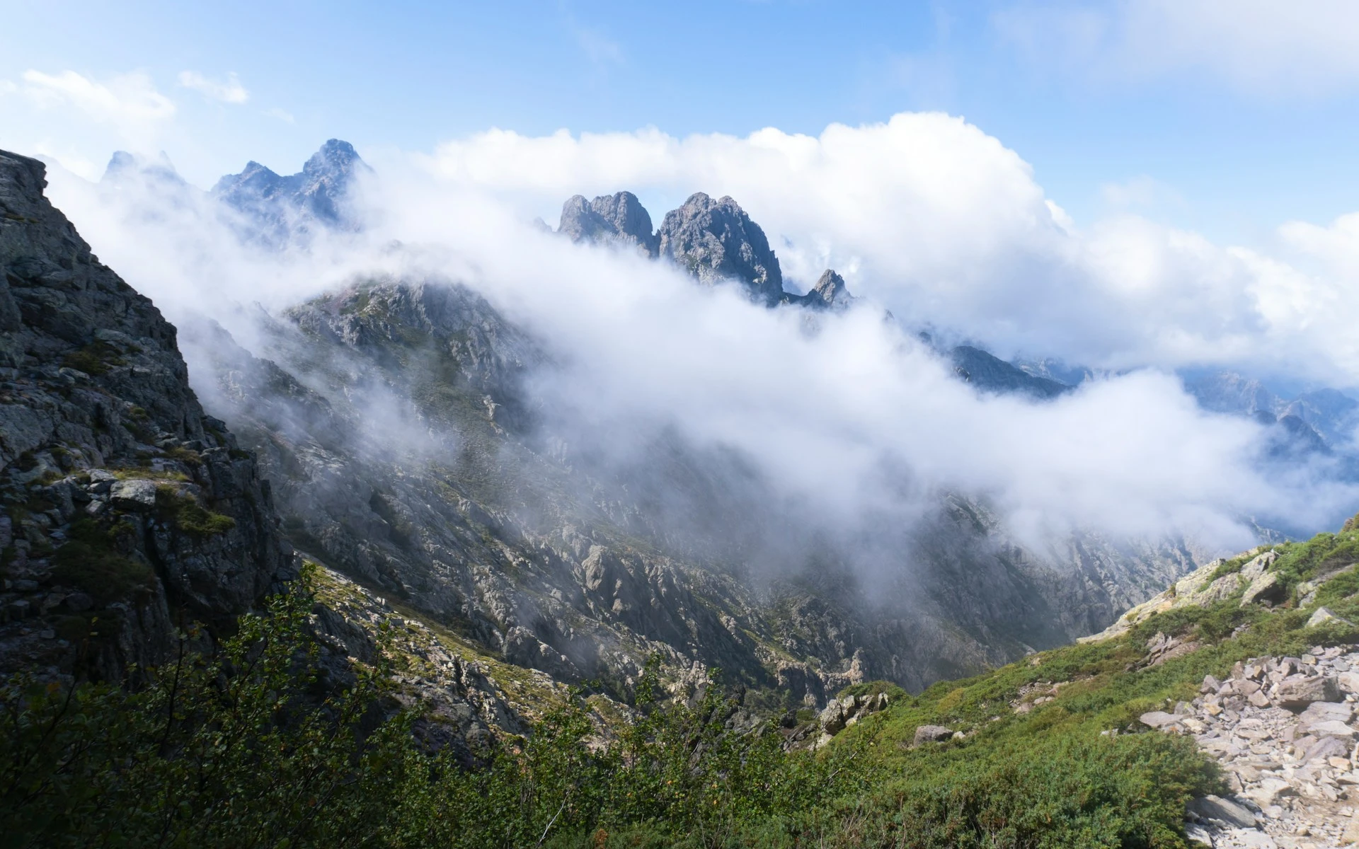
The northern section (Calenzana to Vizzavona) is consistently rated as one of the most technically demanding long-distance trails in Europe. Involves prolonged scrambling on steep granite, exposed ridges, chains and fixed cables on near-vertical rock faces, and sustained navigation on rough unmarked terrain. The southern section is less technical but still demanding. Since the 2015 closure of the Cirque de la Solitude (where fatal accidents occurred), the rerouted section remains challenging. Previous alpine hiking and scrambling experience is essential; the trail is genuinely dangerous for unprepared or unfit hikers. Not a first-time mountain hike.
Marked with red-and-white GR waymarks throughout, but these can be hard to spot on rocky terrain in poor visibility. The trail frequently passes through granite boulder fields where the path is not obvious. A detailed topo map (IGN 1:25,000) and compass are essential. Some sections require route-finding across bare rock between waymarks. Conditions and some variant routes are not reflected in older guidebooks.
Almost entirely on bare granite, scree, boulder fields, and loose rock — there is very little soft path. The sustained rocky terrain is energy-sapping with a heavy pack and demands precise footwork all day. The heat in July and August on south-facing slopes can be extreme (35°C+). The combination of technical terrain, heat, and daily stages of 6–10 hours makes this one of the most physically punishing trails in Europe.
| T1 | Hiking: clear path, no exposure |
| T2 | Mountain Hiking: some uneven terrain |
| T3 | Difficult Mountain Hiking: exposed sections possible |
| T4 | Alpine Hiking: requires sure-footedness |
| T5 | Difficult Alpine Hiking: climbing experience needed |
| T6 | Very Difficult Alpine Hiking: advanced mountaineering |
| Info | Visit About > rating notes or SAC hiking difficulty ratings |
| A dream | Paved/hardpack (but you might reconsider after a 10-hour day) |
| Too easy | Firm dirt/gravel |
| Mind your step | Loose/uneven |
| A bit of a slog | Ongoing sapping surfaces |
| Make it stop! | A total energy sucker |
📅 Best Season
The trail is realistically open from late June to late September when refuges are staffed. Snow closes the northern section until mid-June. July and August are very hot, with heat on south-facing granite a serious hazard; afternoon thunderstorms are frequent and violent in the mountains — get off exposed ridges by early afternoon. Late June and September offer the best balance of conditions and thinner crowds. The trail is possible in May (south to north) for experienced mountaineers with snow gear, but refuges are unstaffed. Outside the season, the GR20 should only be attempted by expert alpinists.
💭 Logistics & Budget
Dirtbag assumes camping at refuge pitches (~€6–9/night) and all food carried from Calenzana or resupplied at Vizzavona. Average assumes refuge dormitory every night (~€14–17) with refuge evening meals (~€15–20) and breakfasts (~€8). Flashpacker adds occasional bergerie meals and hotel nights at Vizzavona. All transactions are cash-only — carry sufficient euros for the entire trail before starting. There are no ATMs anywhere on route. Costs are modest by French standards because there is no alternative to the refuge system.
No hiking permit required. The GR20 lies entirely within the Parc Naturel Régional de Corse. All camping must be within designated sites adjacent to refuges; unauthorised camping anywhere else carries fines.
Calenzana is ~15km from Calvi airport (CLY), served by flights from Paris, Nice, and Marseille. Taxi or shuttle from Calvi to Calenzana. Conca is served by a shuttle (navette) to Sainte-Lucie-de-Porto-Vecchio, then bus north to Bastia or Ajaccio. Figari airport (FSC) is the closest to Conca. Car hire in Corsica is useful for exploring after the hike but long-term parking at trailheads is impractical given the linear route.
Accommodation is exclusively PNRC (Parc Naturel Régional de Corse) refuges and their adjacent designated campsites. Wild camping is strictly prohibited throughout the trail as it lies entirely within the Corsican Regional Nature Park. Refuge dormitory beds cost ~€14–17/night per person; designated camping pitches ~€6–9/night per person. Advance booking via the PNRC website is mandatory for dormitory beds in peak season (July–August) and strongly recommended throughout. The trail is almost entirely cash-only — there are no ATMs anywhere on the route including at Calenzana, Vizzavona, and Conca. Carry all the cash you’ll need before starting. Hotels are available at three midpoints only: Vizzavona, Haut-Asco, and Castel di Vergio.
🎶 Vibe
The GR20 has an intensity that sets it apart from almost every other trail in Europe. The combination of extreme terrain, heat, cash-only economy, and genuine physical suffering creates a shared experience that bonds hikers quickly and deeply. The refuges buzz in the evenings with people comparing notes, tending blisters, and drinking local Corsican wine. The landscape is spectacular in a way that feels almost aggressive — vertiginous granite spires, electric-blue mountain lakes, the smell of maquis scrubland, and sudden panoramic views out to the Mediterranean. Corsica itself rewards those who linger: extraordinary beaches, food (charcuterie, brocciu cheese, chestnut everything), and a fierce, proud culture. The GR20 is a serious undertaking, not a casual holiday — but completing it ranks among the great achievements available to a hiker who does not climb.
🛟 Safety & Inclusion
The GR20 is genuinely dangerous for unprepared hikers. Serious and fatal accidents occur every season. The northern section involves exposed scrambling where a fall has severe consequences. Afternoon thunderstorms develop rapidly and strike ridgelines with little warning — always check morning forecasts at refuges and plan stages to be off high ground by early afternoon. Rescue by helicopter is possible but expensive and weather-dependent. An emergency contact plan and ideally a satellite communicator are strongly recommended. Over 50% of hikers who start do not complete the full route.
📍 Trails in the Same Region


Suggest a correction
Help keep GR20 accurate. Only the values you change are submitted, and every suggestion is reviewed before going live.