📊 Technical Details
No technical climbing, but the path’s constant steep ascents and descents at every headland and cove make it surprisingly demanding. The total ascent of 11,000m over 299km is comparable to the Pennine Way. The northern section (Fishguard to St Dogmaels) is the most rugged, with exposed cliff sections requiring care in wet conditions. The Castlemartin limestone cliffs involve some exposed path above serious drops. Overall accessible to fit recreational walkers but not a gentle stroll.
National Trail with excellent acorn waymarking throughout. One of the easiest long-distance routes to navigate in the UK. The coastal path rarely moves far from the cliff edge so directional errors are self-correcting. The dedicated walker bus network and road access at many points means help is never far away.
Mostly well-maintained coastal path with good surfaces. Some sections become very muddy after rain. The path crosses private farmland extensively and can be overgrown in summer. The two MOD diversions at Castlemartin and Penally take the route inland on less scenic tracks. The Milford Haven oil terminal section passes through industrial landscape — the most visually jarring stretch of the whole route.
| T1 | Hiking: clear path, no exposure |
| T2 | Mountain Hiking: some uneven terrain |
| T3 | Difficult Mountain Hiking: exposed sections possible |
| T4 | Alpine Hiking: requires sure-footedness |
| T5 | Difficult Alpine Hiking: climbing experience needed |
| T6 | Very Difficult Alpine Hiking: advanced mountaineering |
| Info | Visit About > rating notes or SAC hiking difficulty ratings |
| A dream | Paved/hardpack (but you might reconsider after a 10-hour day) |
| Too easy | Firm dirt/gravel |
| Mind your step | Loose/uneven |
| A bit of a slog | Ongoing sapping surfaces |
| Make it stop! | A total energy sucker |
📅 Best Season
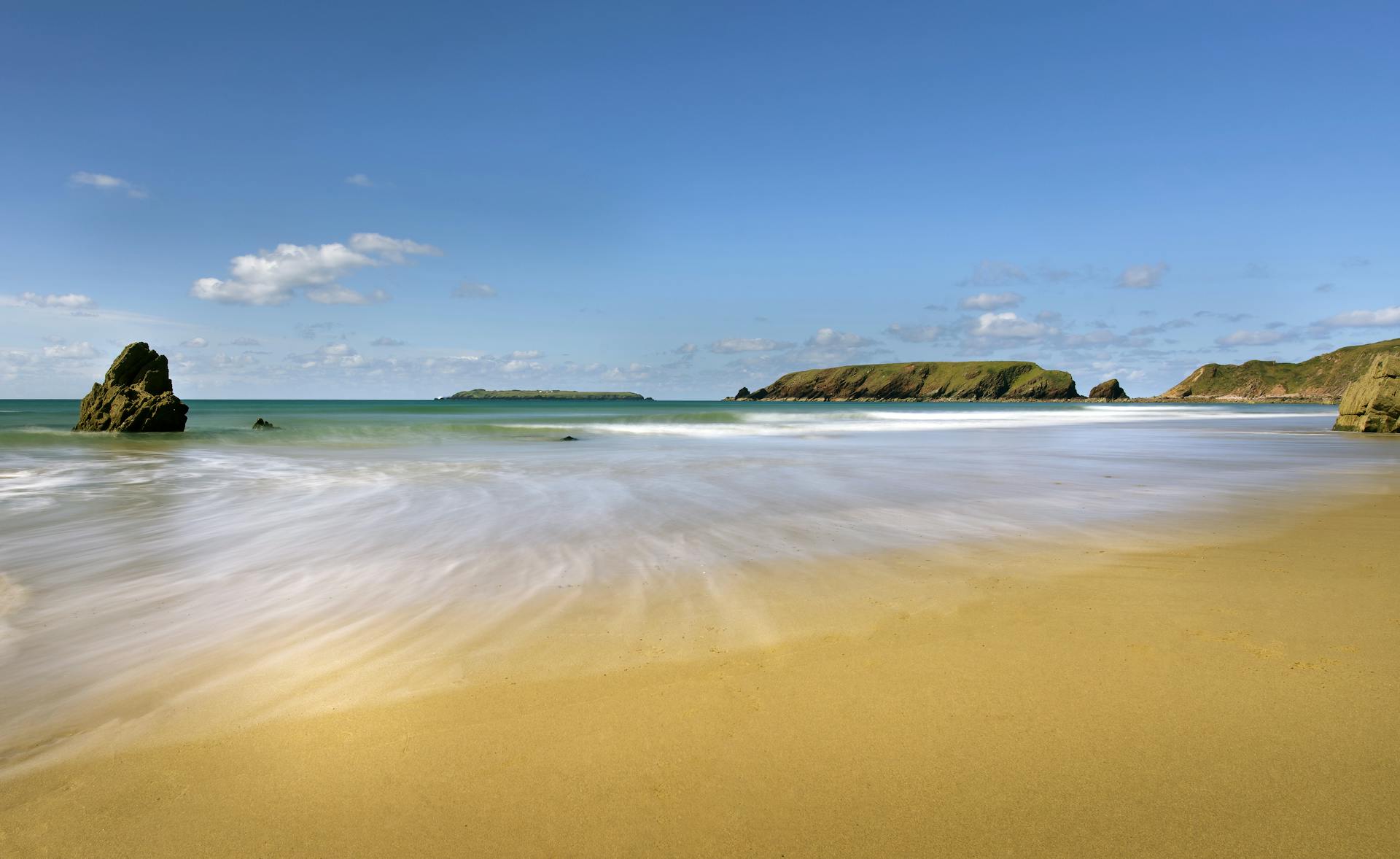
Walkable year-round with a mild Atlantic climate. Best May–September. Spring (May–June) is ideal: wildflowers in full bloom, puffins and other seabirds on the cliffs, fewer crowds than summer. July–August is peak season: crowded, expensive, and parking at trailheads fills early. Autumn is beautiful and quiet. Winter is mild by UK standards but storms can make cliff-top sections dangerous — take local advice. The path passes through Britain’s only coastal national park.
💭 Logistics & Budget
Budgets in euros at approx 1.15 GBP/EUR. Wales is generally cheaper than England for accommodation. Dirtbag assumes campsites (~£10–18/night) and cooking own food. Average assumes B&Bs (~£50–70pp) and pub meals. The St David’s area and Tenby are the most expensive sections. Cardigan and Fishguard are more affordable. Generally good value by UK coastal path standards.
No permit required. National Trail. MOD range closures apply on the Castlemartin and Penally sections — check firing times at pembrokeshirecoast.wales before walking these sections.
Amroth: bus from Tenby; Tenby has direct trains from Cardiff (~2.5hrs) and connections to London. St Dogmaels: bus from Cardigan (~10min); Cardigan is served by bus from Carmarthen and Aberystwyth. Nearest major rail stations are Fishguard Harbour (mid-route, for ferries to Ireland), Haverfordwest, and Pembroke Dock. The dedicated walker buses along the path make it very practical to do sections and return to accommodation.
Well-serviced route with B&Bs, guesthouses, campsites, and hotels in most overnight stops. The Pembrokeshire Coast National Park operates dedicated walker buses (Puffin Shuttle, Coastal Cruiser, Celtic Coaster, Strumble Shuttle, Poppit Rocket) that serve the entire length of the path — a very well-thought-out network that makes section walking and getting back to accommodation easy. Wild camping is not permitted. Two sections pass through active MOD ranges (Castlemartin and Penally) where the path may be diverted — check pembrokeshirecoast.wales for current closures. Book accommodation well ahead in July–August especially in St David’s.
🎶 Vibe
The Pembrokeshire Coast Path offers some of the finest coastal walking in Britain on a compact and accessible route. In two weeks you experience everything the Atlantic edge of Wales has to offer: the dramatic volcanic headlands and Iron Age forts of the north; the sweeping sandy bays and medieval castles of the south; the cathedral city of St David’s (the smallest city in Britain) at the midpoint; seals sunbathing on hidden beaches; choughs (the red-billed crow of Wales) working the cliff-face turf; and the best fish and chips you have ever eaten in Tenby. The bilingual Welsh and English culture gives the path a distinct character from English National Trails. The famous walker buses make it exceptionally easy to do sections — it is perhaps the most accessible thru-hike in Britain, and one of the most rewarding.
🛟 Safety & Inclusion
The main hazard is cliff edges — some sections are very exposed with serious drops and no barriers. Take particular care in wet and windy conditions and when distracted by the excellent wildlife. Some cliff sections are subject to ongoing erosion — follow diversion signs. Sandy Haven and two other tidal crossings require timing: check tide tables before attempting to wade across or take the inland alternative. MOD range sections must not be entered when red flags are flying.
🔗 Similar Trails
📍 Trails in the Same Region


Suggest a correction
Help keep Pembrokeshire Coast Path accurate. Only the values you change are submitted, and every suggestion is reviewed before going live.