📊 Technical Details
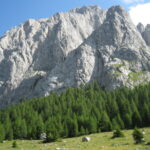
More demanding than most popoluar Alpine walking routes. The standard route includes a near-vertical ladder section at Pas de Chèvres (the main route to Arolla), exposed rocky ridges, steep scree descents, and occasional seasonal snowfields on high passes. The Europaweg variant (final two stages) involves loose hillsides, boulder fields, and some route-finding. There are no glacier crossings or technical climbing required but the terrain demands confident hill walking, good balance on rocky ground, and tolerance for exposure.
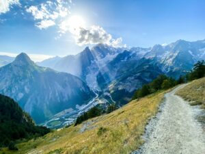
More complex than for example the TMB. The route is not a single signed trail but a network of braided alternatives. Hikers must choose their line at multiple decision points, and the signposting varies considerably between French and Swiss sections. A detailed route guide (the Cicerone Trekking Chamonix to Zermatt by Kev Reynolds is the standard) and 1:25,000 IGN (France) and SwissTopo (Switzerland) maps are essential. Remember to download offline maps. GPS signal is available but phone receeption is absent on many ridge sections. The Europaweg section in particular requires route-finding competence.
The route regularly descends 1,000–1,500m into valleys only to immediately climb the same amount on the other side. On many stages this feels punishing rather than purposeful. The Grand Désert section between Cabane du Mont Fort and Cabane de Prafleuri is barren and can be psychologically grinding in bad weather. The ladder at Pas de Chèvres is non-trivial in wet conditions. Some stages are long (8–10hrs) with significant cumulative altitude. Arriving at a cold hut after 1,500m of climbing is standard.
| T1 | Hiking: clear path, no exposure |
| T2 | Mountain Hiking: some uneven terrain |
| T3 | Difficult Mountain Hiking: exposed sections possible |
| T4 | Alpine Hiking: requires sure-footedness |
| T5 | Difficult Alpine Hiking: climbing experience needed |
| T6 | Very Difficult Alpine Hiking: advanced mountaineering |
| Info | Visit About > rating notes or SAC hiking difficulty ratings |
| A dream | Paved/hardpack (but you might reconsider after a 10-hour day) |
| Too easy | Firm dirt/gravel |
| Mind your step | Loose/uneven |
| A bit of a slog | Ongoing sapping surfaces |
| Make it stop! | A total energy sucker |
📅 Best Season
Late June is possible but some high passes may have lingering snow and crampons may be required. July–August is peak with huts fully booked weeks ahead, good weather, and the longest days. September is excellent: fewer hikers, autumn colours beginning, and stable weather, but some huts begin closing from mid-September. Winter alpine equipment and strong navigation experience required prior to late June or after October and navigation experience. Check Cicerone errata pages (see links below) before departure for route closures (rockfall/slide closures are common, particularly on the Europaweg which has been rerouted multiple times).
💭 Logistics & Budget
Switzerland is one of the most expensive countries in the world. France is somewhat cheaper but still expensive in the Alps. Dirtbag assumes hut dorms throughout (~€45-60 demi-pension) and self-catered lunches. Average assumes mix of hut and valley hotel nights (~€80-120 valley hotels) and hut dinners. Flashpacker adds hotel nights in Verbier and Zermatt and restaurant lunches. The Europaweg variant adds 2 extra hut nights. SAC/CAF membership (~€65/year) pays for itself within 3-4 hut nights. Overall, the Walker’s Haute Route is substantially more expensive than the Tour du Mont Blanc due to the Swiss portion. Budget at minimum €100-120/day.
No permit required. Both the French and Swiss sections are on public rights of way. SAC or CAF Alpine Club membership is recommended for hut discounts but not mandatory. The route crosses the French-Swiss border without a formal checkpoint.
Chamonix: train from Geneva (~2hrs) or direct Eurostar connection from London St Pancras via Paris. Geneva Airport has extensive European and intercontinental connections.
Zermatt is car-free and nearest road-accessible station (Täsch) is a 12min ride.
Zermatt to Geneva by train ~3.5hrs. Both ends are well connected to European rail networks and a car is unnecessary and impractical.
Alternates between Alpine mountain huts (CAF refuges and SAC Hütten) and valley hotels and guesthouses. The rhythm of hut and hotel nights is one of the great pleasures of the route. Swiss Alpine Club (SAC) hut membership provides discounts (~50%) on hut fees and is worth obtaining for the Swiss sections. French CAF refuges are also discounted for members. Hut demi-pension (dorm bed, dinner, breakfast) typically costs €45-70; valley hotel nights €80-150. Advance booking is essential in July & August. Some popular huts (Cabane de Moiry, Cabane de Prafleuri) book out weeks ahead. The Europaweg variant into Zermatt (the final two stages) requires two additional nights in high mountain huts. Wild camping is not permitted in most sections. The route can be walked in halves, with Arolla at the midpoint as a natural breaking point.
🎶 Vibe
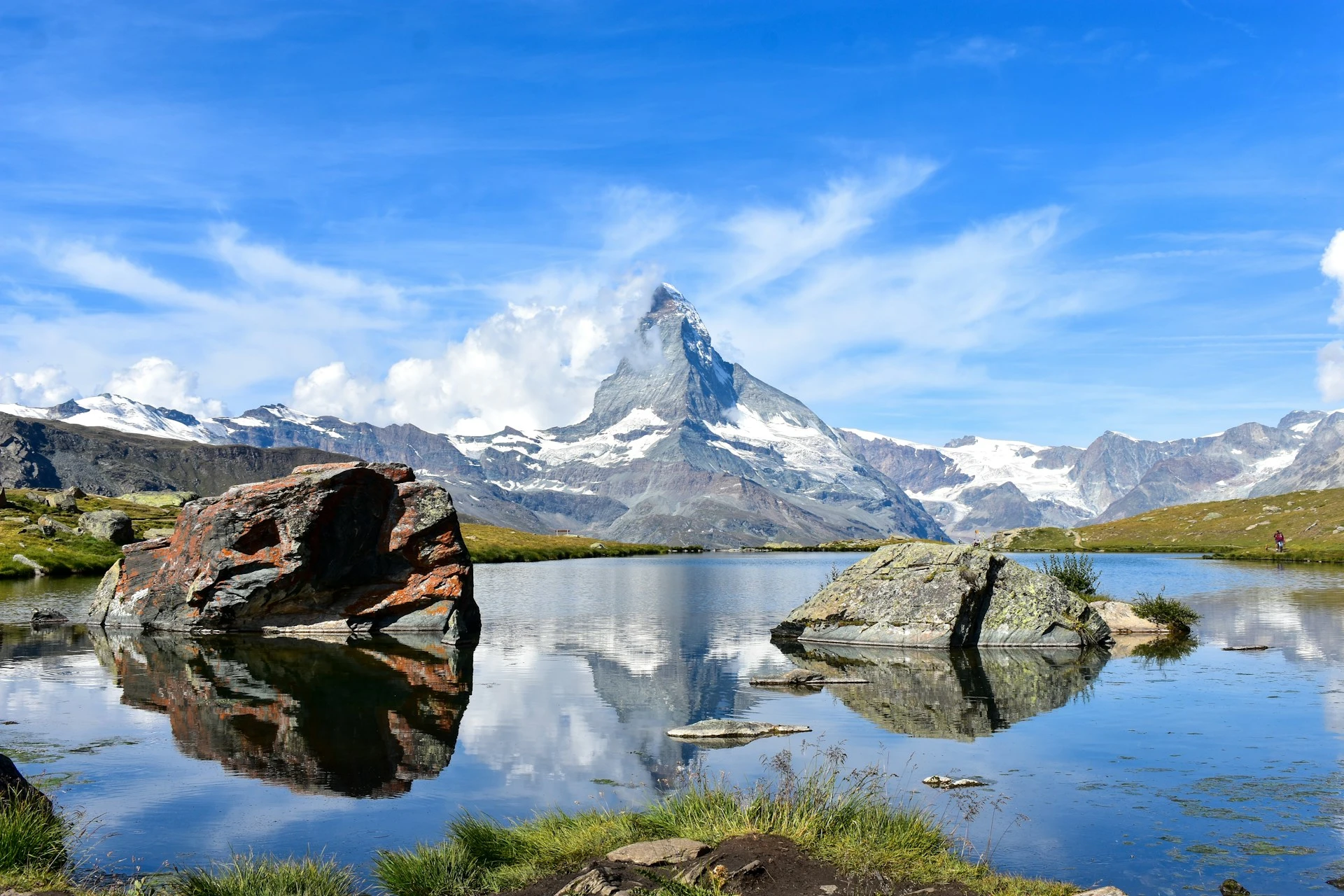
The Walker’s Haute Route is the Alps at their most sustained and magnificent. Two weeks connecting the two greatest mountain icons in Europe, from the shadow of Mont Blanc to the foot of the Matterhorn, through the heart of the Valais. Unlike the TMB, which encircles and returns, the Haute Route is a crossing – a journey with genuine forward momentum and constant geographic progress. Each day reveals a new valley, a new mountain range, a new glacier. The Grand Combin rises like a wall on day 5, the approach to Cabane de Moiry with its glacier pouring into the valley below stops people in their tracks, the Europaweg above the Mattertal with the Weisshorn hanging impossibly overhead, and then Zermatt and the Matterhorn, earned after two weeks of effort and too magnificent to capture with your smartphone. The hut culture in Switzerland is exceptional. SAC huts are warm, well-run, and social in a way that encourages the best of the international hiking community. Harder, longer, and more expensive than the TMB, this trail rewards the extra effort with something the TMB cannot quite match: a genuine sense of having traversed a mountain range rather than circled a single massif.
🛟 Safety & Inclusion
Afternoon thunderstorms are the primary acute hazard. They can be violent and develop quickly with exposed ridges becoming dangerous. Always be off high passes by early afternoon. The Pas de Chèvres ladder and Europaweg loose hillsides are accident-prone in the wet. Alternatives routes are aviailable in bad weather. Snow and ice on early-season passes require crampons. The Europaweg has experienced serious rockfall. Check for current closures at the Zermatt tourism office before beginning. Please do not forgo comprehensive alpine travel insurance.
🔗 Similar Trails
📍 Trails in the Same Region


Suggest a correction
Help keep Walker’s Haute Route accurate. Only the values you change are submitted, and every suggestion is reviewed before going live.