📊 Technical Details
No technical terrain whatsoever. The Ridgeway is the gentlest of the National Trails — a rolling chalk and flint track across open downland, then woodland paths through the Chilterns. The highest point is just 261m and the gradients are mild throughout. Suitable for any reasonably fit walker with comfortable footwear. The main physical challenge is simply the daily distance rather than terrain difficulty. The western chalk track becomes very muddy after rain and can be heavy going underfoot.
Exceptionally well-waymarked with the National Trail acorn symbol throughout. One of the easiest National Trails to navigate — the broad chalk track of the western section essentially navigates itself, and the Chilterns section is clearly signed at every junction. OS 1:25,000 maps are recommended but a smartphone with a maps app is sufficient for most walkers.
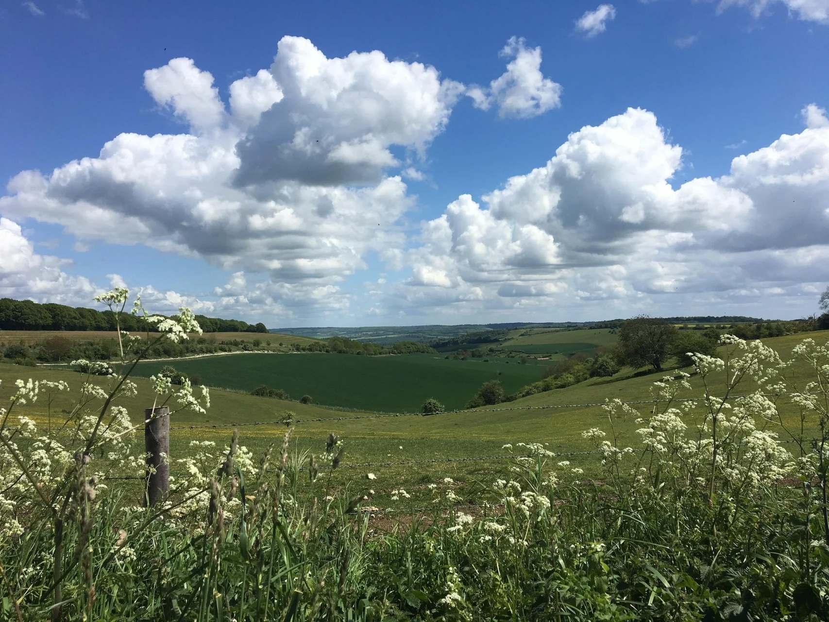
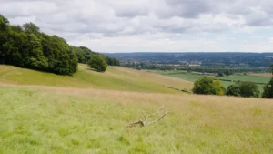
The western chalk track section (roughly the first 43 miles) is a broad, straight, often muddy bridleway shared with mountain bikes, horses, and occasionally legal motorised vehicles — it can feel more like a farm track than a hiking trail and lacks the intimacy of most National Trails. The scenery across open chalk downland is expansive rather than dramatic. The Chilterns section (east of Streatley) is significantly more varied and prettier, with beech woodland, valley views, and attractive villages. Some stretches cross or follow roads.
| T1 | Hiking: clear path, no exposure |
| T2 | Mountain Hiking: some uneven terrain |
| T3 | Difficult Mountain Hiking: exposed sections possible |
| T4 | Alpine Hiking: requires sure-footedness |
| T5 | Difficult Alpine Hiking: climbing experience needed |
| T6 | Very Difficult Alpine Hiking: advanced mountaineering |
| Info | Visit About > rating notes or SAC hiking difficulty ratings |
| A dream | Paved/hardpack (but you might reconsider after a 10-hour day) |
| Too easy | Firm dirt/gravel |
| Mind your step | Loose/uneven |
| A bit of a slog | Ongoing sapping surfaces |
| Make it stop! | A total energy sucker |
📅 Best Season
Walkable year-round but best May–September. Summer gives long days for the flatter open sections and the chalk downland wildflowers are spectacular in June–July. The western chalk track becomes extremely muddy October–March after rain — can be very unpleasant in wet winters. Autumn through the Chiltern beech woods (October–November) is beautiful. The trail is close enough to London to attract significant weekend foot and cycle traffic in summer — start on a Monday for a quieter experience.
💭 Logistics & Budget
Budgets in euros at approx 1.15 GBP/EUR. Dirtbag assumes campsites (~£12–20/night) and cooking own food. Average assumes B&Bs (~£55–75pp) and pub meals. The Ridgeway passes through or near some excellent Cotswold-fringe and Chiltern villages with classic English country pubs — budget for at least a few proper pub lunches and evening meals. The western chalk track section has fewer eating options directly on the trail; carry packed food for the longer stages.
No permit required. National Trail.
Overton Hill: nearest station is Swindon (~8 miles, taxi required) or Pewsey on the Waterloo–Penzance line. Avebury itself is worth a full day before starting — Stonehenge is nearby. Ivinghoe Beacon: Tring station (~2 miles, taxi) on the Euston–Birmingham line. London Euston to Tring ~40min — excellent for London-based end-to-end hikers doing the trail west to east (EBO) and returning to London from the finish. The Thames at Goring Gap (mid-point) has direct trains to London Paddington (~1hr) — a natural halfway point.
Good B&B and pub accommodation throughout, with campsites available on or near most stages. The western section (Overton Hill to the Thames at Streatley) is more remote with fewer villages and limited accommodation directly on the trail — some walking to nearby villages is required. The eastern section (Streatley to Ivinghoe Beacon) passes through more settled countryside with better trail-side accommodation options. Wild camping is not permitted. Baggage transfer services are available from several local operators. The western section is primarily a broad chalk track shared with cyclists, horses and (in some sections) vehicles — choose weekdays to avoid weekend mountain bike and equestrian traffic.
🎶 Vibe
The Ridgeway is Britain’s oldest road, and walking it is an exercise in deep time. For at least 5,000 years, and probably longer, people have been moving along this chalk ridge above the Vale of the White Horse: traders, drovers, soldiers, and pilgrims. The prehistoric monuments are extraordinary and numerous: Avebury stone circle at the start (larger and older than Stonehenge), Wayland’s Smithy (a neolithic burial chamber) in its grove of beech trees, the Uffington White Horse cut into the hillside 3,000 years ago and still white, and a sequence of Iron Age hill forts commanding the ridge. The physical walking is gentle but the western chalk track section has a sweeping, windswept quality that feels genuinely ancient in a way that few trails in southern England manage. The Chilterns section is smaller-scale but charming with beech hangers, thatched villages, and flint churches. The Ridgeway is the ideal first National Trail for a walker new to long-distance hiking in England, and a satisfying short break for experienced walkers who want history rather than wilderness.
🛟 Safety & Inclusion
Essentially no significant safety hazards. The most notable issues are the western section’s shared use with vehicles on some byway sections, which requires road sense; the occasional aggressive cattle on farmland sections; and the exposure of the open chalk down in summer heat — sun protection and water are more important than they might seem on such a low-level trail.
🔗 Similar Trails
📍 Trails in the Same Region


Suggest a correction
Help keep The Ridgeway accurate. Only the values you change are submitted, and every suggestion is reviewed before going live.