Open
Camino de Santiago (Francés)
Distance
km
Elev. Gain
m
Duration
33
days
Grade
T1
Route
Point-to-Point
Effort
Gentle
📊 Technical Details
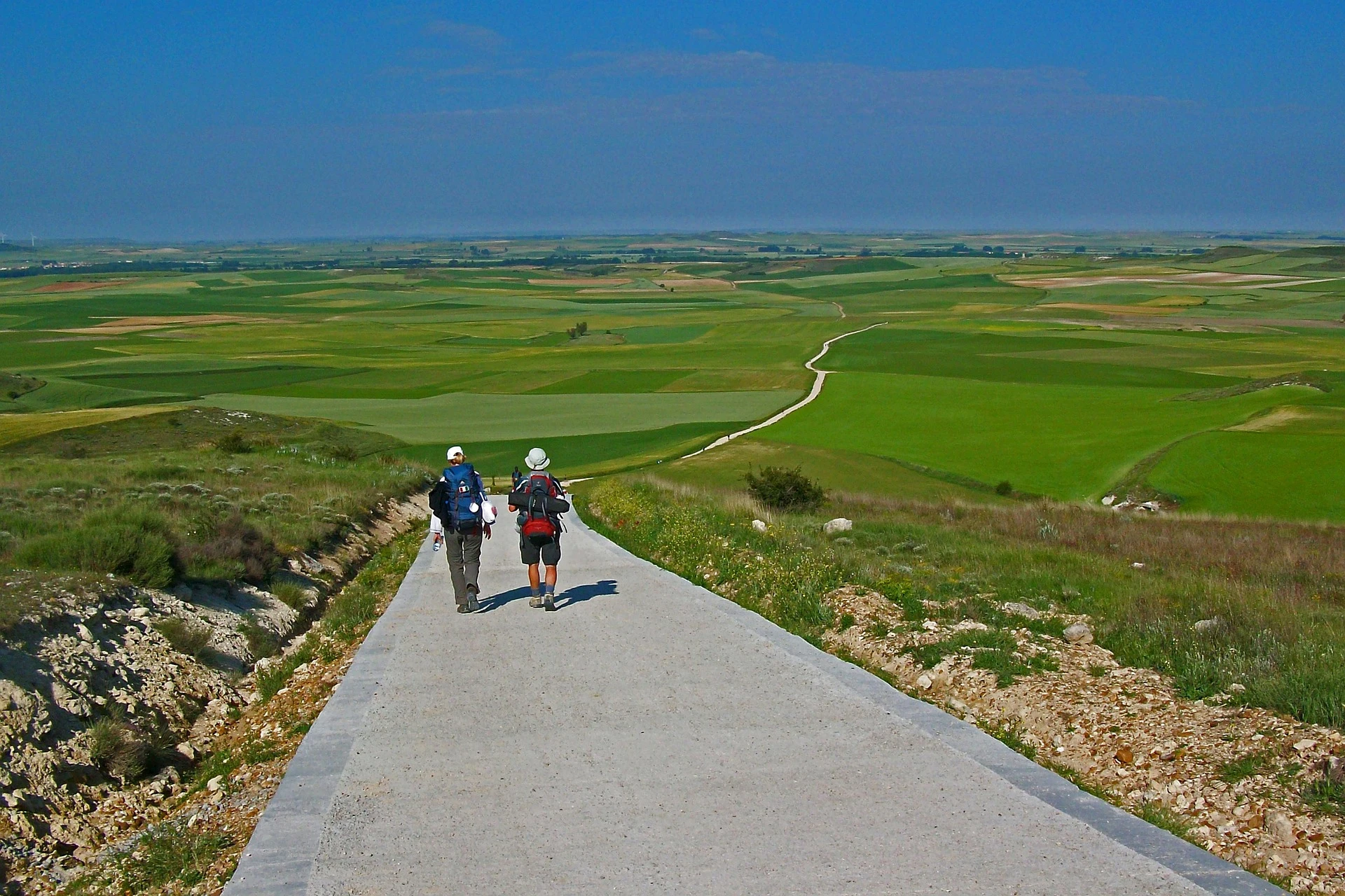
No technical terrain. Day 1 over the Pyrenees (Napoleon Route) is strenuous but on a clear path; an easy valley alternative (Valcarlos route) exists and is mandatory in winter. The rest of the route is on paths, tracks, and some road. Well-marked throughout with yellow arrows and scallop shells.
The best-signed long-distance route in the world. Yellow arrows appear every few hundred metres throughout Spain. Navigation requires almost no skill. The first section in France follows the GR65 with red-and-white blazes.
Mix of earth paths, gravel tracks, and some road/tarmac. The Meseta section (Burgos to León, ~200km) is flat, exposed dirt track. The Galician sections are often muddy and stone-paved. Some road walking unavoidable, notably leaving Burgos and around industrial areas.
| T1 | Hiking: clear path, no exposure |
| T2 | Mountain Hiking: some uneven terrain |
| T3 | Difficult Mountain Hiking: exposed sections possible |
| T4 | Alpine Hiking: requires sure-footedness |
| T5 | Difficult Alpine Hiking: climbing experience needed |
| T6 | Very Difficult Alpine Hiking: advanced mountaineering |
| Info | Visit About > rating notes or SAC hiking difficulty ratings |
| A dream | Paved/hardpack (but you might reconsider after a 10-hour day) |
| Too easy | Firm dirt/gravel |
| Mind your step | Loose/uneven |
| A bit of a slog | Ongoing sapping surfaces |
| Make it stop! | A total energy sucker |
📅 Best Season
Walkable year-round. Summer (June–August) is peak: very crowded, hot on the Meseta, beds scarce. Spring (April–May) and autumn (September–October) are ideal: mild weather, thinner crowds, most albergues open. Winter walking is possible but many albergues close; the Pyrenees crossing can be dangerous with snow (Valcarlos route mandatory Nov–March). The Botafumeiro pilgrim mass at Santiago is held at noon daily.
💭 Logistics & Budget
Dirtbag assumes municipal albergues (€10–12/night) and supermarket food. Average assumes private albergues and the daily pilgrim menu (menú del peregrino: 3 courses, bread and wine for ~€12). Flashpacker assumes private rooms, restaurant dinners, and occasional baggage transfer. The Francés is the cheapest Camino route due to sheer density of municipal albergues and pilgrim-menu restaurants. First day in France (SJPP) is notably more expensive than Spain.
No permit required. A Pilgrim Credential (Credencial del Peregrino) is needed to stay in albergues and to receive the Compostela certificate. It can be obtained from pilgrim offices, churches, and many albergues along the route.
Saint-Jean-Pied-de-Port is reached by train via Bayonne (TGV connections from Paris). Nearest airports: Biarritz (30km) or Bilbao (150km). Long-term parking not practical at the start; fly/train in is the standard approach. Santiago de Compostela has its own airport with connections to major European cities.
The most densely serviced long-distance route in the world. Municipal albergues (public pilgrim hostels) charge €10–12/night and are first-come-first-served; private albergues €15–20 and can be booked ahead. Both require a Pilgrim Credential. Donativo albergues exist throughout. Private rooms in guesthouses and hotels widely available in larger towns. Beds in Galicia fill quickly June–August; start early or book ahead. Wild camping is illegal throughout Spain and explicitly prohibited in protected areas along the route; given the density of affordable albergues there is no practical need to camp.
🎶 Vibe
The Camino Francés is the world’s most popular long-distance pilgrimage and feels it. An extraordinary multicultural river of humanity — pilgrims from Korea, Brazil, the US, Germany, all walking together. The social culture is intense and joyful: trail families form fast, every bar doubles as a pilgrim hub, and the communal pilgrim dinner is a nightly ritual. Spirituality, self-challenge, and tourism exist in equal measure. The Meseta polarises people: some find it meditative, others just want it to end. Galicia in the final week feels like a homecoming. Arriving at the Cathedral Praza do Obradoiro is one of the great emotional experiences in hiking.
🛟 Safety & Inclusion
One of the safest long-distance routes in the world. Petty theft from albergue common rooms (leave nothing of value unattended). The Pyrenees crossing can be dangerous in bad weather — check conditions before departing SJPP. Heat on the Meseta in July–August is the most common health risk. Well-supported emergency infrastructure throughout.
🔗 Similar Trails
📍 Trails in the Same Region


Suggest a correction
Help keep Camino de Santiago (Francés) accurate. Only the values you change are submitted, and every suggestion is reviewed before going live.