📊 Technical Details
No technical climbing or scrambling, but the trail is consistently steep and rocky with significant daily ascent and descent. Ancient Roman roads, mule tracks, and goat paths make up most of the route — hard, loose, and uneven underfoot throughout. A reasonable level of fitness is required. Trail running shoes or light hiking boots work well; heavy boots are unnecessary. Trekking poles are highly recommended for the endless steep descents.
Waymarked with red-and-white GR-style blazes and yellow junction signs, but the marking is inconsistent and poorly maintained in many sections — gaps of a kilometre or more without any mark are common. A GPS track (TrailSmart app or downloaded GPX from the Culture Routes Society website) is essential and not optional. The Kate Clow guidebook is helpful for cultural context but the maps are too small-scale for reliable navigation. Several parallel goat paths make it easy to drift off-route. Download offline maps before each stage.
Relentlessly rocky underfoot — Roman road paving stones, loose limestone, and sharp coastal rock dominate. The daily ascent and descent profile is brutal relative to the distance covered; 1,000m of gain and loss per day is typical. The heat in May and September (let alone summer) is significant and shade is limited on coastal sections. Trail maintenance is variable and some sections are significantly overgrown. Despite all this, the scenery and cultural richness make it one of the most rewarding trails in the world.
| T1 | Hiking: clear path, no exposure |
| T2 | Mountain Hiking: some uneven terrain |
| T3 | Difficult Mountain Hiking: exposed sections possible |
| T4 | Alpine Hiking: requires sure-footedness |
| T5 | Difficult Alpine Hiking: climbing experience needed |
| T6 | Very Difficult Alpine Hiking: advanced mountaineering |
| Info | Visit About > rating notes or SAC hiking difficulty ratings |
| A dream | Paved/hardpack (but you might reconsider after a 10-hour day) |
| Too easy | Firm dirt/gravel |
| Mind your step | Loose/uneven |
| A bit of a slog | Ongoing sapping surfaces |
| Make it stop! | A total energy sucker |
📅 Best Season
Spring (February–May) and autumn (September–November) are the only viable windows. February is often warmer and drier than March, and is enthusiastically recommended by the trail’s creator Kate Clow. Summer (June–August) is genuinely unsuitable — temperatures regularly exceed 40°C on coastal sections with no shade and no water. Winter brings rain, storms, and snow above 1,500m on the high sections. The trail is open year-round but summer hiking is dangerous.
💭 Logistics & Budget
One of the most affordable long-distance trails in Europe. Dirtbag assumes wild camping and cooking own food (Turkish supermarkets are cheap and well-stocked). Average assumes nightly pansiyons including dinner and breakfast (~€15–25pp all-in) plus lunch at village cafes. Flashpacker adds coastal resort towns (Kaş, Kalkan, Çıralı) where boutique hotels and restaurants are noticeably pricier. Turkey’s high inflation makes lira prices volatile — costs expressed in euros are more stable but check current exchange rates. Overall exceptional value.
No hiking permit required. The route passes through several protected natural areas; no fees apply for walking through them. Entry to archaeological sites along the route (Xanthos, Myra, Phaselis etc.) charges standard Turkish museum admission fees (typically €3–8).
Western start (Hisarönü/Ovacık): Dalaman Airport is ~45km away; regular dolmuş (minibus) connections via Fethiye. Eastern end (Geyikbayırı): daily buses to Antalya city centre (Antalya Airport has flights throughout Europe). Good public transport (dolmuş) along most of the coast allows section hiking without a car.
Good coverage for most of the route — accommodation is available every night in village pensions (pansiyons), small hotels, or guesthouses except on three high-level inland sections where wild camping is necessary. Village pansiyons are the heart of the Lycian Way experience: family-run, invariably including dinner and breakfast, and extraordinarily good value (typically €10–25pp including meals). Wild camping is entirely legal in Turkey and spots are plentiful along coastal and inland sections. Many coastal areas also have basic campsites. Bring cash — ATMs are scarce between major towns (Kaş, Fethiye, Antalya are the main ATM stops), and most pansiyons and rural restaurants are cash-only. Shepherd dogs (Kangal-type) are a common hazard near high pastures — approach calmly and slowly.
🎶 Vibe
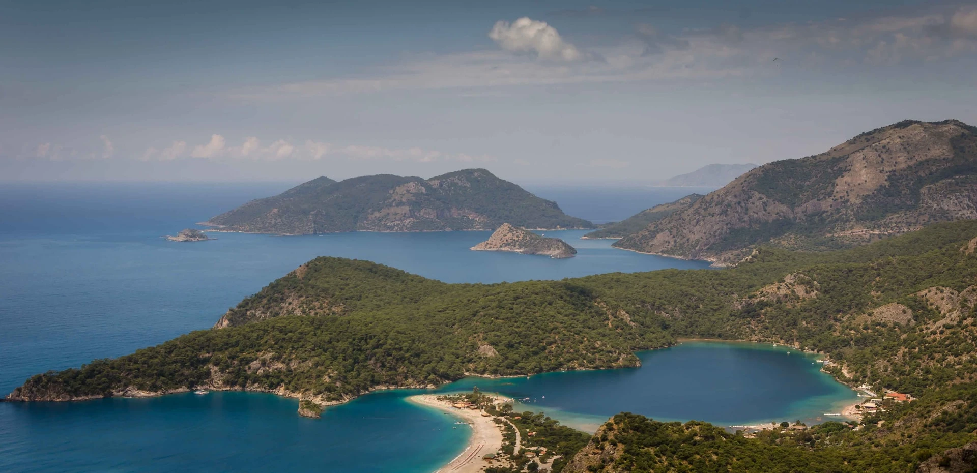
The Lycian Way passes through one of the most historically layered landscapes on earth — Lycian rock tombs carved into cliff faces, Roman theatres overgrown with figs, Byzantine churches crumbling on headlands, ghost villages emptied in the 1923 population exchange. And then the sea: turquoise, impossibly clear, accessible for a swim off nearly every coastal stage. Turkish village hospitality is legendary and genuine — chai appears from nowhere, pansiyons serve breakfasts that take 30 minutes to lay out and leave you unable to walk. The trail is relatively unknown outside Turkey and you will spend long days without seeing another hiker, which makes the occasional encounter with a fellow walker all the more memorable. One of the great undiscovered long-distance trails of Europe.
🛟 Safety & Inclusion
The main hazards are heat and dehydration (summer), shepherd dogs near high pastures (approach calmly, never run), and snakes, scorpions, and spiders (shake out boots every morning, never put hands into crevices). Some river crossings can be tricky after heavy rain. The trail is very remote between villages on the high sections — carry a full day’s water beyond what you expect to need. Turkey is politically stable and the trail area has no security concerns for tourists.
🔗 Similar Trails
📍 Trails in the Same Region


Suggest a correction
Help keep Lycian Way accurate. Only the values you change are submitted, and every suggestion is reviewed before going live.