📊 Technical Details
No technical terrain — no scrambling, ladders (with minor exceptions), or route-finding difficulty. The challenge is purely cumulative: 35,000m of elevation gain spread over 1,014km means constant short, sharp ascents and descents at every headland and river mouth. The North Devon and Exmoor sections in the first few days are the most relentlessly up-and-down. Some cliff sections are exposed and require care in wet or windy conditions. Landslips periodically close sections; check southwestcoastpath.org.uk for current route changes.
Waymarked throughout as a National Trail with acorn symbols. In good visibility navigation is simple. Mist and low cloud (common year-round) can make cliff-edge sections harder to follow. The path frequently diverts inland due to landslips with temporary signage. A current guidebook or the official SWCP app is recommended.
Mostly firm coastal paths, some beach sections, and unavoidable road walking through larger towns and villages. The sheer quantity of short climbs and descents is the defining physical challenge — the path rarely stays at the same height for more than a few hundred metres. The Jurassic Coast section (Dorset) is notably easier and more varied underfoot.
| T1 | Hiking: clear path, no exposure |
| T2 | Mountain Hiking: some uneven terrain |
| T3 | Difficult Mountain Hiking: exposed sections possible |
| T4 | Alpine Hiking: requires sure-footedness |
| T5 | Difficult Alpine Hiking: climbing experience needed |
| T6 | Very Difficult Alpine Hiking: advanced mountaineering |
| Info | Visit About > rating notes or SAC hiking difficulty ratings |
| A dream | Paved/hardpack (but you might reconsider after a 10-hour day) |
| Too easy | Firm dirt/gravel |
| Mind your step | Loose/uneven |
| A bit of a slog | Ongoing sapping surfaces |
| Make it stop! | A total energy sucker |
📅 Best Season
Walkable year-round. Summer (June–August) is peak: accommodation must be booked months in advance in popular sections, popular beaches and villages are very crowded, but weather is most reliable. Spring (April–May) and autumn (September–October) are ideal: wildflowers and migratory birds in spring, dramatic light and emptier paths in autumn. Winter walking is possible and spectacular in storms, but some accommodation closes and days are short. The Exmoor and North Devon sections are the most exposed and wet year-round.
💭 Logistics & Budget
In GBP: dirtbag assumes campsite pitches (£10–15/night) and supermarket food supplemented by pub lunches. Average assumes a mix of campsites and B&Bs (£50–70pp/night) with pub meals. Flashpacker assumes B&Bs or small hotels every night with restaurant dinners. Budgets expressed in euros at approx 1.15 GBP/EUR rate. Prices vary significantly: North Devon and rural sections are cheaper; Cornwall, especially in summer, is significantly more expensive. A small passenger ferry fee (typically £2–5) is required at several crossing points.
No permit required. The path is a designated National Trail maintained by Natural England. A section near Lulworth in Dorset passes through a military firing range which closes for exercises — check lulworth.co.uk/ranges for opening times.
Minehead is served by bus from Taunton (rail connections to London Paddington). Poole has direct rail connections to London Waterloo. Both ends reachable within 3–4 hours from London. Local bus network (FirstBus in Devon/Cornwall) covers most of the route and is essential for section walkers getting back to cars or accommodation. A small passenger ferry crosses the Exe estuary at Exmouth/Starcross and there are several other short ferry crossings (Fowey, Plymouth, Poole Harbour) that are route-critical.
Extremely well-serviced route with accommodation available every few kilometres along most sections. Options range from campsites (£10–20/night) through YHA and independent hostels (dorms from £18–30/night), B&Bs and guesthouses (£50–100/night pp), to hotels and spas. Look for ‘Way Maker’ listed accommodation — businesses specifically set up for walkers with drying facilities, flexible breakfast, and single-night booking. Wild camping is not permitted; the path crosses private land throughout and you must stay at official campsites. Book ahead for popular sections in Cornwall and Dorset in summer. Some accommodation has minimum 2-night stays in peak season.
🎶 Vibe
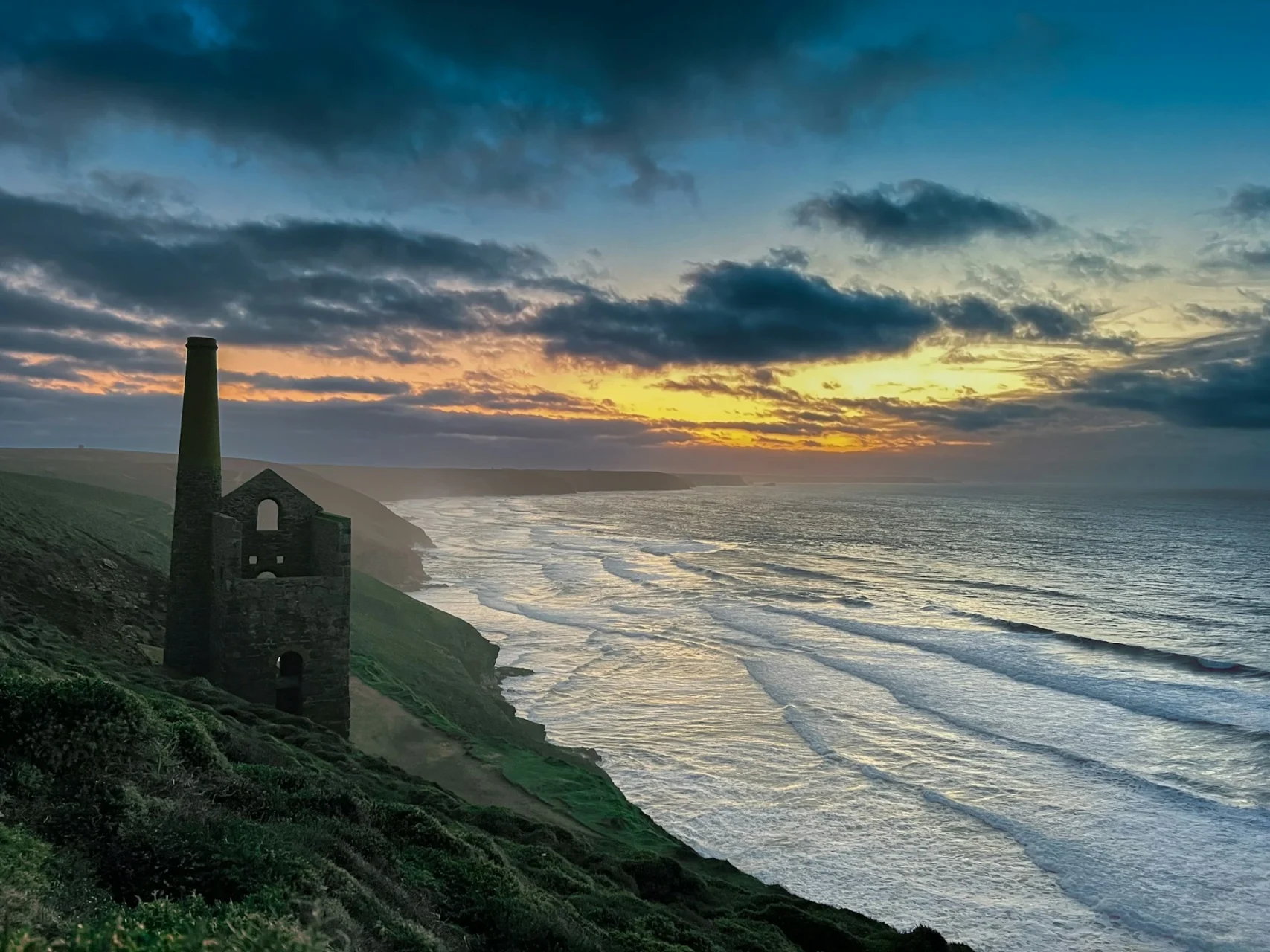
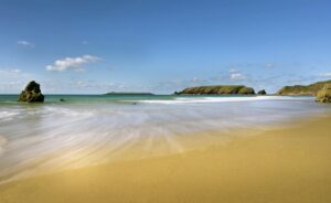
The SWCP is Britain’s great coastal epic — 630 miles of the country’s most spectacular coastline, passing through fishing villages, surf towns, industrial heritage, prehistoric cliff forts, and some of the best pub food in England. The character shifts dramatically over its length: the wild, remote cliffs of Exmoor and North Devon; the surf culture of Croyde and Polzeath; the dramatic mining landscape of West Cornwall; the picturesque harbours of the South Cornwall coast; the Jurassic Coast fossils and chalk stacks of Dorset. Most walkers do it in sections over several years. Full thru-hikers are a small, slightly mad community who earn enormous respect from the locals they meet. The path is particularly strong on pub culture — a pint with a sea view at the end of each day is close to mandatory.
🛟 Safety & Inclusion
The main hazard is cliff edges — some sections are very exposed with significant drops and no barriers. Particular care is needed in wet and windy conditions, and when distracted (photographing). Do not approach eroding cliff edges; chalk and sandstone cliffs can give way without warning, particularly on the Jurassic Coast. The Lulworth military range section (Dorset) closes for live firing — always check before walking. Mobile signal is unreliable in deep valleys and remote headlands; tell someone your itinerary.
🔗 Similar Trails
📍 Trails in the Same Region


Suggest a correction
Help keep South West Coast Path accurate. Only the values you change are submitted, and every suggestion is reviewed before going live.